Categories: Internet & Communications, Travel & Navigation
Upload date: 5 Nov 11
Developer: Waze
License: Freeware
Downloads: 4814 File Size: 8774 Kb
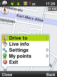
Waze: Community GPS navigation - Waze is a free, 100% user-generated, social navigation app that allows drivers to build and use live maps & real-time traffic updates to improve their daily commute.
In addition to providing turn-by-turn navigation, waze also gives drivers the ability to actively update one other on traffic, police traps, construction, speedcams and more, reflecting a live description of the road at any given moment and because it's user-generated, the more people who use it, the better (and more fun) it gets!
Here is what users are saying about us:
* Im in love already! I don't usually get this excited about things, but I am about waze.
* Coolest navigation app I've seen in a while, hope more people sign up in my area!!
* Waze is an amazing collaborative GPS mapping application!
***
Constantly-updated road map
Real-time traffic updates
Automatic rerouting
Live reports from users on the road
Turn-by turn directions
Road tweets - Twitter integration
Picture sharing from the road
Like it? Share with your friends!
Supported operating systems:
Google Android 1.0, Google Android 1.5, Google Android 1.6, Google Android 10.x, Google Android 2.0, Google Android 2.1, Google Android 2.2, Google Android 2.3, Google Android 3.0, Google Android 3.1, Google Android 3.2, Google Android 4.0, Google Android 4.1, Google Android 4.2, Google Android 4.3, Google Android 4.4, Google Android 5.x, Google Android 6.x, Google Android 7.x, Google Android 8.x, Google Android 9.x
Similar Software:
Speedometer GPS HD Speedometer GPS HD - Speedometer GPS HD can display more info on one screen.
Speedometer GPS HD can track your speed,distance,time,location and also can get start time,time elapased,avg speed,max speed,altitude...
Features included
- Save your track info,Record gpx file(it will be saved in "sdcard/SpeedometerGPSHD/gpx/")
MapMyRIDE GPS Cycling Riding MapMyRIDE GPS Cycling Riding - tracks the route, distance, pace, and more in real-time using GPS.
NEW: iMapMyRIDE+ for Android
iMapMyRIDE+ brings you its mobile app for Android-based devices! Now owners of Android 2
GPS Dashboard GPS Dashboard - View the status of the GPS on your phone with this cool Dashboard
In Hand Deals In Hand Deals - In Hand Deals is an easy to use mobile app that provides you with the most effective way to find out what deals are available in different categories or around your location; such as restaurants, fast food, coffee shops, retail stores, automotive, fuel, day spas, beauty salons, theaters and nightclubs.
No need to coupon clip, check in, or score points...
iMapMyRUN Run GPS Running Jog iMapMyRUN Run GPS Running Jog - iMapMyRUN+ tracks the route, distance, pace, and more in real-time using GPS.
Free new version!
iMapMyRUN+ brings you its mobile app for Android-based devices! Now owners of Android 2
GoPenS GoPenS is an OpenSource GPS application for Android phones, based on OpenStreetMap (OSM). OpenStreetMap is a collaborative map of the world. Therefore, one of the main functions of the application is to be able to record a trace and send it as a GPX to the OSM servers, and so edit the OSM Map
Maps In My Pocket (MIMP) Maps In My Pocket - The main goal of this application is to allow its users to view maps, locate themselves, follow KML or GPX formatted tracks and getting directions from place to place.
What's New in This Release:
· New Icon
What's New in 1.4.3:
· Long press and long pinch concurrency on info bubble solved
OSMTracker for Android OSMTracker stands for OpenStreetMap Tracker. It allows you to track your journey and mark significant way points. Way points can be marked with a tag using a button, with a quick voice record, a text note or by taking a picture. The various button pages and layouts can be customized to suit your OpenStreetMap activities
Garmin Tracker (Android) Garmin Tracker (Android) - Brought to you by the worldwide leader in GPS, Garmin Tracker — combined with a GPS-enabled Garmin tracking device (purchase required) — lets you track what’s important while on the go.
Garmin Tracker is a free, unique application that will help keep tabs on whatever is important to you
ParkLeitSystem ParkLeitSystem is a car-park-routing system. It shows you, according to your GPS position, the nearest city with a car-park-routing system and gives you a list with all available car-parkings and shows how many free places there are. With a click on the parking it switches to google maps and shows you the position of the parking
Other Software by developer «Waze»:
Waze Waze is a free, 100% user-generated, social navigation application that allows drivers to build and use live maps & real-time traffic updates to improve their daily commute
Waze (iPhone/iPad) Waze is a free, 100% user-generated, social navigation application that allows drivers to build and use live maps & real-time traffic updates to improve their daily commute
waze Waze - Waze is a free, 100% user-generated, social navigation application that allows drivers to build and use live maps & real-time traffic updates to improve their daily commute
Waze Waze is a free, 100% user-generated, social navigation application that allows drivers to build and use live maps & real-time traffic updates to improve their daily commute
Waze Waze is a free, 100% user-generated, social navigation application that allows drivers to build and use live maps & real-time traffic updates to improve their daily commute
If you noted an error or download link is broken, please, report it via this page or use comments.
Waze: Community GPS navigation is compatible with your device Xiaomi Redmi Note 7 Global Dual SIM TD-LTE 64GB M1901F7G / Redmi Note Seven (Xiaomi Lavender)

")


")


")


