VGPS (Vietnamese GPS) for Android was designed to use city street map on your ordinary mobile phone without the need of having GPS receiver or internet connection. VGPS does not require internal or external GPS receiver. However, if you have internal GPS receiver or external bluetooth GPS receiver, VGPS can work with your GPS receiver as well. VGPS does not require internet connection so you no need to worry about connection charge.
· Offline map (totally offline application. VGPS only uses internet to validate your purchase when you activate demo version become full version. Other than that the application will never use internet)
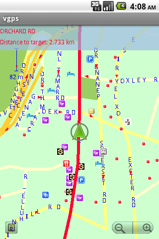
· Map data from Garmin and OpenStreetMap
· Zoom in/Zoom out/Pan
· Search point by name,type,distance or mix type+name, type+distance
· Can touch any object on the map
· GPS real-time tracking
· Routing point to point
· Rotate map so the driving direction (heading) is always up
· Voice guidance (turn left/turn right)
What's New in This Release:
· User can take screenshot and save to memory card
What's New in 7.0:
· Supports all android phones and tablets screen sizes and densities (android 1.5 to android 3.2+)
What's New in 6.9:
· pinch to zoom in/out
Like it? Share with your friends!
Supported operating systems:
Google Android 1.5, Google Android 1.6, Google Android 10.x, Google Android 2.0, Google Android 2.1, Google Android 2.2, Google Android 2.3, Google Android 3.0, Google Android 3.1, Google Android 3.2, Google Android 4.0, Google Android 4.1, Google Android 4.2, Google Android 4.3, Google Android 4.4, Google Android 5.x, Google Android 6.x, Google Android 7.x, Google Android 8.x, Google Android 9.x
Similar Software:
DEWA (Android) DEWA - Welcome to the Mobile World of DEWA
Wizi SMS with Location (Android) Wizi SMS with Location lets you instantly share your location with anyone by SMS. The location map can be opened on any mobile phone with a browser, namely older phones. This tiny application is available for free and does not require registration
InstaMapper (Android) InstaMapper is a free service that allows you to track a person or vehicle online in real time using a GPS-enabled mobile phone.
To use InstaMapper, you create a free account. Registration takes only a minute or two. All it is asked for is a username, password, and a valid email address.
Next, you install a small application on your GPS-enabled phone
Current Location Finder Current Location Finder - Current Location finder which can be used to locate your location with the aid of a live satellite map you can dynamically (real time) determine ... Use the live satellite maps
GPS2OpenGTS Free GPS2OpenGTS will send your GPS data to an OpenGTS tracking system.
Latest version now supports UDP.
Also added is a Test function/screen to help with server configuration.
Send a NMEA GPRMC strings with the following data.
(accountID, deviceID, Latitude, Longitude, Speed, Heading and Altitude
My Tracks My Tracks - Use My Tracks while you run, bike, hike, or do anything else outdoors, and it will use the GPS sensor in your Android phone to record the path you took. It will also gather useful statistics such as time, speed, distance, and elevation. You can review all of this data live, or you can save it for use later
Open GPS Tracker Open Source recording, storing and accessing of your routes: Open GPS TrackerAn application that can track your travels of your Android by storing your GPS locations. Draws the route real-time on either Google or OSM maps
runtastic GPS Coach Your personal GPS sports assistant for running, cycling, walking, hiking, ... runtastic GPS is your personal running and fitness application for all outdoor (running, nordic walking, hiking, skating,..) and indoor sports (treadmill, cardio, yoga, bodybuilding)
Zeen - Building Road Awareness Zeen, building road awareness together! Zeen is a fully featured, community driven mapping solution. - Over 500,000 data points at launch! Will continue to build thanks to the community! - Police Locations - Red Light Camera Locations - Speed Camera Locations - Traffic Reports / Locations
Redpin The aim of the Redpin project is to create an open source system that allows indoor positioning up to room-level description using mobile phones
Other Software by developer «Vietnamese GPS»:
VGPS (Vietnamese GPS) for Android VGPS was designed to use city street map on your ordinary mobile phone without the need of having GPS receiver or internet connection. VGPS does not require internal or external GPS receiver. However, if you have internal GPS receiver or external bluetooth GPS receiver, VGPS can work with your GPS receiver as well
VGPS (Vietnamese GPS) VGPS (Vietnamese GPS) - was designed to use city street map on your ordinary mobile phone without the need of having GPS receiver or internet connection. VGPS does not require internal or external GPS receiver. However, if you have internal GPS receiver or external bluetooth GPS receiver, VGPS can work with your GPS receiver as well


 for Android")
 for Android")
")
")
")


 for Android")
")