WAY - Where are you? - Share you location and find your friends easily.
Wanna find your friends?
Wanna share your location with friends?
Congratulations: YOU FOUND THE APPLICATION WHICH ALLOWS YOU THAT AND EVEN MORE.
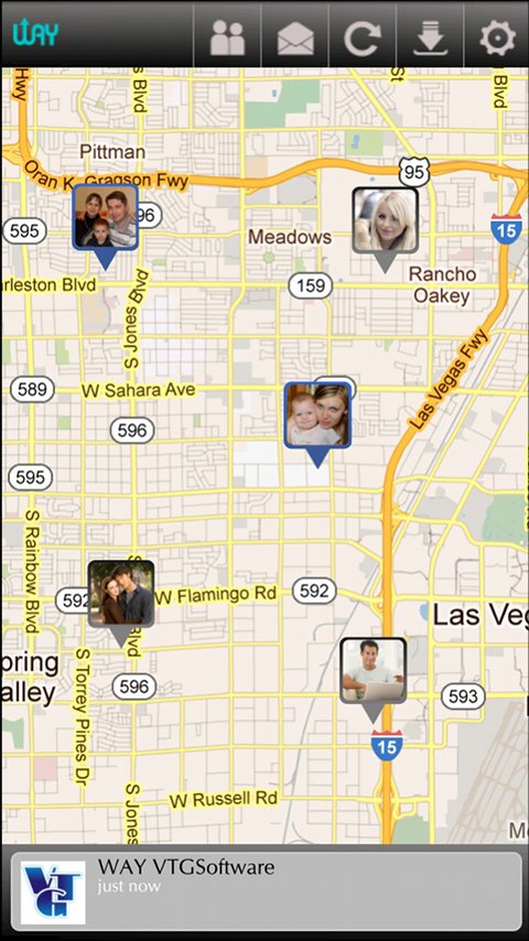
"WAY - Where are you?" allows you to find your friends' locations in real time and/or send them free messages.
Now we just have one global permission by which you can enable/disable your location sharing.
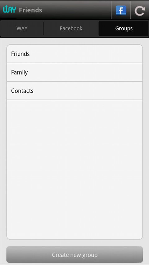
"WAY - Where are you?" has social networks (now just Facebook) integration which means that you can find your social networks friends in real time.
"WAY - Where are you?" has grouping, which allows you to group your friends (WAY and other social networks) and send them messages just by selecting the group.
Possible ways to use "WAY - Where are you?":
* Sending messages to all your friends easy and free (no SMS).
* Finding/checking your friends' location where you're also invited.
* Finding your kids' locations and knowing where they are (without calling them).
* Sending your location to your friend.
This application needs following permissions:
* Fine (GPS) and coarse (network-based) location permissions are using to find your location for sharing.
* View network state and full Internet access permissions are for communicating with the WAY and/or other social networks services.
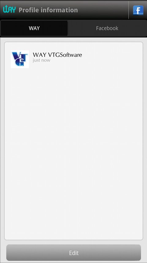
* Get account permission is for getting your email address for WAY profile, we use email address just for forgot password functionality.
* Read phone state and identity permission is for getting your phone number, be cause "WAY - Where are you?" using the phone number as the user's username.
* Receive boot completed permission is using for running our location sending service after phone reboots.
* Read contacts permission is for reading your contacts and matching with existing WAY users, to find already registered friends.
* Receive SMS permission is for receiving account verification SMS, which is necessary to activate your WAY account.
* Write external storage permission is used for caching images in SD card.
We always welcome feedback from you.
Like it? Share with your friends!
Supported operating systems:
Google Android 1.5, Google Android 1.6, Google Android 10.x, Google Android 2.0, Google Android 2.1, Google Android 2.2, Google Android 2.3, Google Android 3.0, Google Android 3.1, Google Android 3.2, Google Android 4.0, Google Android 4.1, Google Android 4.2, Google Android 4.3, Google Android 4.4, Google Android 5.x, Google Android 6.x, Google Android 7.x, Google Android 8.x, Google Android 9.x
Similar Software:
Strava running and cycling GPS Strava - this application is for people who like running, cycling or just spend time outside
Gps Traveler Gps Traveler - Gps Traveler is a complete gps tools for android including compass,speedometer,gps Information such as speed,altitude,location address infromation
NAVIGON USA for Android NAVIGON USA for Android - NAVIGON turns your mobile device into a fully featured GPS navigation system. The software provides advanced functionality for both drivers and pedestrians, including 2D and 3D maps, route planner, speed assistant, voice directions, local search, and more.
NAVIGON uses offline maps, so you don't need to worry about data traffic or roaming charges
ParkLeitSystem ParkLeitSystem is a car-park-routing system. It shows you, according to your GPS position, the nearest city with a car-park-routing system and gives you a list with all available car-parkings and shows how many free places there are. With a click on the parking it switches to google maps and shows you the position of the parking
amAze (Android) AmAze is a first of its kind free navigation and local search service. It is free to download and use and it contains wide coverage of maps including aerial photo in Europe, North America, Australia and parts of Asia and Africa
AugSatNav Walk AugSatNav is an augmented reality navigation system which overlays walking directions upon a live video feed of the path or road ahead.
With AugSatNav there is no need to follow instructions or interpret maps - you can simply find your way by walking along the route highlighted by a bright white line
GeoBeagle GeoBeagle is a free, open source application for the Android platform to aid users in finding geocaches and letterboxes. It enables the user to do paperless geocaching.
Geocaches and letterboxes are objects that have been hidden in the real world; the game of geocaching/letterboxing is finding these objects around you
BeBack Light BeBack Light - A GPS tracking and voice navigation utility economizing the battery charge.Suitable for hunters, fishers or other adventure finders: allows to walk straight to the target point with free hands according to the voice pointers, having your PDA in a pocket with the switched off screen and saving the battery charge on the way
Metosphere (Android) Metosphere Explore and create virtual objects around your physical location like messages, emergency alerts, events, news, reviews, games. View geospatial data from Wikipedia, Eventful, and Upcoming. Start a GeoBlog on your GPS-enabled phone.
This is the core Metosphere Android app
AlpineQuest Lite AlpineQuest Lite - AlpineQuest turns your Android device into an off-road GPS using offline topo maps. It is a complete solution for all outdoor activities and sports, including hiking, running, trailing, hunting, sailing, geocaching and much more
Other Software by developer «VTGSoftware»:
not found
Comments on WAY - Where are you?:
Comments not found
If you noted an error or download link is broken, please, report it via this page or use comments.
WAY - Where are you? is compatible with your device Vivo X1S


")


")
