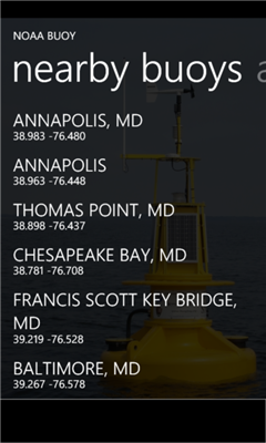
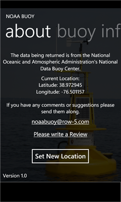
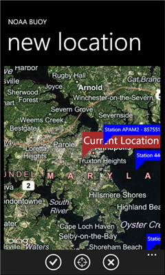
NOAA Buoy - The National Oceanic and Atmospheric Administration keeps a database of information retrieved from smart buoys. This app retrieves the data from the buoys surrounding your current location. You can also change your location to look for other buoys.
Like it? Share with your friends!
If you got an error while installing Themes, Software or Games, please, read FAQ.
Supported operating systems:
Windows 10 Mobile, Windows Phone 7, Windows Phone 8
Similar Software:
GPS Distance GPS Distance - GPS Distance vous permet de calculer rapidement et facilement la distance i vol d'aoiseau qu'il y a entre deux coordonnees GPS.
Les coordonnees sont donnees de facon decimales representant la valeur de l'angle en degre et le resultat est donnee en kilometre
Infusion LIS Mobile Locator Infusion LIS Mobile Locator - Don't miss the chance to be there when your customers need you. INFUSION LIS MOBILE LOCATOR LET YOUR CUSTOMERS FIND YOU FASTER.
Infusion LIS Mobile Locator guides customers to your business quickly and accurately
Gps info Simple program to show your current Position on a map with location data latitude, longitude, course, speed, altitude
GPS-Data-App This app shows the latitude and the longitude of your GPS
GPS to SMS Free GPS to SMS Free is an app that makes it possible to share your current location by sending it via SMS or e-mail. The message contains the GPS position data and a link to Google Maps.
It also works (limited) without internet connection, so its a great tool for trips to foreign countries where the roaming costs are often very high, to tell your friends where you are
Mount Rainier National Park Mount Rainier National Park - Shows your location on the national park map. This app does not require a cellular or wireless connectivity, so it works in areas that don't have any network. It displays a map of the national park, with your GPS location on it
FSX Viewer FSX Viewer you can track your current flight on Microsoft Flight Simulator X. Start FSX Tracer on your desktop PC and follow your aircraft on your WP7 device using a detailed Bing map! Stay updated with your longitude, latitude, speed and others fundamental flight parameters. A must-have for all flight simmers!
Version 1
Distant Distant tells you where places are in relation to where you are now. It lists your places in order of distance, and colour codes them so that it is easy to tell at a glance whether you are getting closer or further away. It also tells you how long it will take to get there if you keep moving at the current speed
RunBuddy-Free RunBuddy was started as a project to help me train for a half marathon using my new phone. I wanted a simple GPS Running application where I can review the different miles in my run and past runs to see how my training is progressing. RunBuddy will help you find where during a run your pace slows and how you are improving over time
Other Software by developer «Row 5 Information Systems»:
Lunar Phase Lunar Phase - Show the current phase of the moon and the name of the phase. It also has a list of dates for the next years worth of New and Full moons. You can select a date to see what the moon will/would have looked like on that date