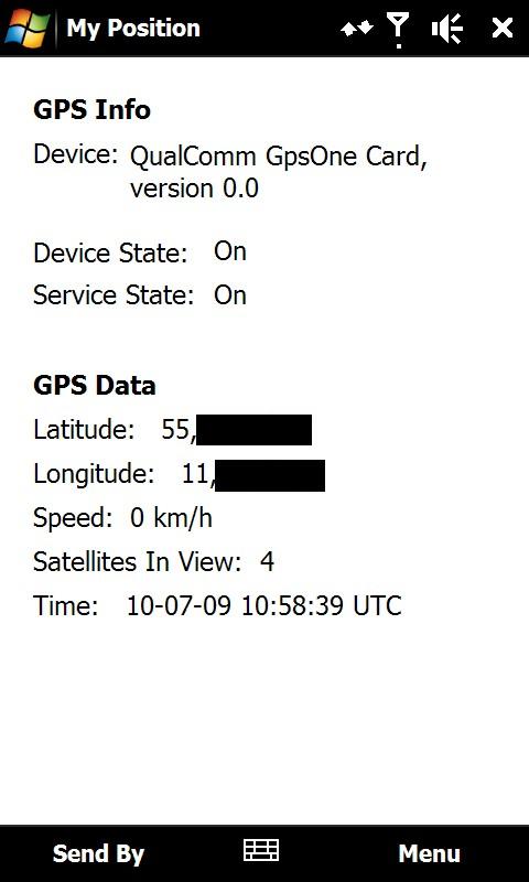
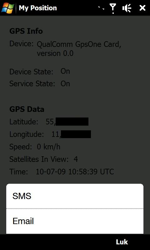
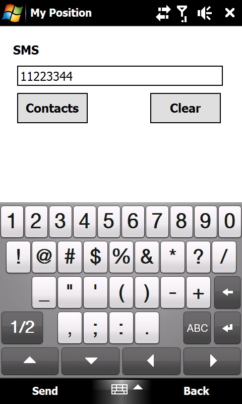
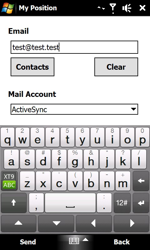
My Position - With My Position it is possible to see actual GPS information via the phone's built in GPS and send the position to others via sms or email.
When sending the position via sms or email it is possible to enter a telephone number or email address. It is also possible to select a contact from the contact list.
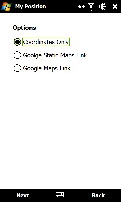
Sending the position is possible in three different ways:
1) As coordinates which can be inserted directly in Google Earth or Google Maps.
2) As a link to Google Static Maps. When the receiver opens the link the phones default web browser connects to the internet and shows the position on a map in 400x400 pixel resolution.
3) As a link to Google Maps. This option is mostly suitable when sending the position via email.
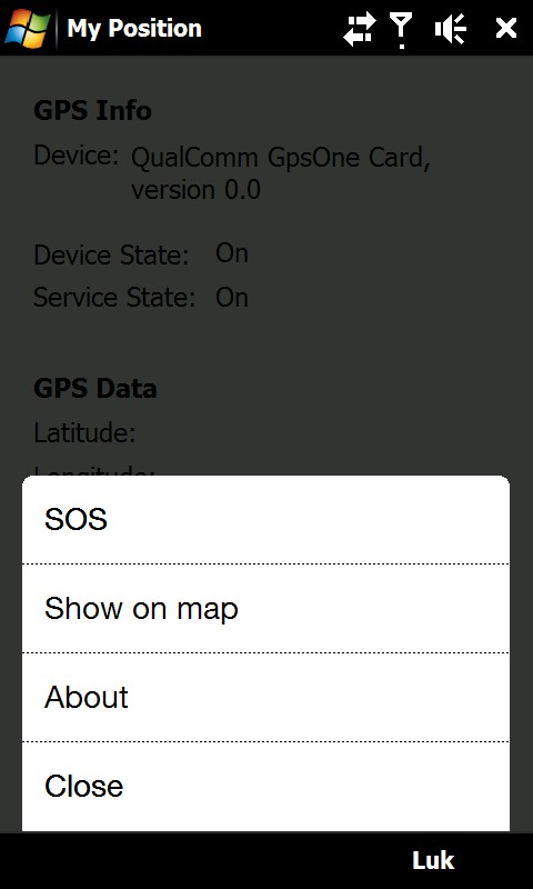
It is also possible to see ones own position on a map where Google Static Map is being used. The phones default web browser will open and connect to the internet and shows the position on a map in 400x400 pixel resolution.
This is a very good function when you are in a big city with many streets.
There is also a sos function which sends the position and a message of help. Again it is possible to send via sms or email.
Like it? Share with your friends!
If you got an error while installing Themes, Software or Games, please, read FAQ.
Supported operating systems:
Windows Mobile 6 Classic, Windows Mobile 6 Professional, Windows Mobile 6.1 Classic, Windows Mobile 6.1 Professional, Windows Mobile 6.5 Professional
Similar Software:
BlueWave GPS Displays GPS navigational information for boating
ContactGPSer ContactGPSer allows you to create and view phone/SMS/email contact number '.cgps' links and Dial/SMS or Email the contacts via GPS distance. Select 'Start GPS' to get a GPS lock and create a new '.pgps' contact link. The program displays the distance between each contact via your current GPS
FON Access Points for Switzerland FON Access Points for Switzerland - FON offers you a new Points of Interest service (POIs). This allows you to download FONspots directly to your navigation device.
What does that mean? You can download a Points of Interest file directly to your navigation device
DocumentGPSs DocumentGPSs - DocumentGPSs can be used to make Pocket Word documents with a GPS tag as the sheet file name. Each time you make a sheet the document it is named the latitude and longitude of your GPS. You can store your files on the storage card. You can also view the Documents with Google maps.
This program requires that you have both the 'BeanDLL
FON Access Points for Serbia and Montenegro FON Access Points for Serbia and Montenegro - FON offers you a new Points of Interest service (POIs). This allows you to download FONspots directly to your navigation device.
What does that mean? You can download a Points of Interest file directly to your navigation device
NoniGPSPlot NoniGPSPlot allows you to locate your position in relation to other GPS points and to see the journey you have made.
It may be used to find your starting place in a port after sailing, or the place where you start a walking or biking excursion, or even your car in a parking. Any place long as you know its GPS coordinates.
It stores the whole journey too
myLocation myLocation- It seems like websites and online services are popping up everywhere that can use location to give you more relevant information. Accuweather and others feature location aware weather sites and Google Maps can accept coordinate information to return location aware search results. Of course, with positional awareness comes controversy
MapDrawerer MapDrawerer allows you to download a Google.com map of your current GPS and edit it with a full-featured drawing tool. You can draw on the map and also insert text into the maps as well as use the drawing tools. The JPEG libraries are from Independent JPEG Group. The map service is provided by Google
TravelGPSeds TravelGPSeds - TravelGPSeds uses the GPS on your PocketPC to find your current latitude/longitude/speed and altitude and allows you to view your position on a map from the Google.com maps service. You can customize the maps zoom, and type via the 'Options' in the toolbar.
This program requires that you have both the 'BeanDLL
TextGPSed TextGPSed - TextGPSed can be used to make text files with a GPS tag as the text file name. Each time you make a file the file is named the latitude and longitude of the file. You can store your files on the storage card. You can also view the text files with Google maps.
This program requires that you have both the 'BeanDLL
Other Software by developer «ULJ»:
Backlight Control A small and simple application to control the backlight