Terracrosser is a free GPS navigation software for Windows Mobile Pocket PC.
· Terracrosser works in Map and Photo modes
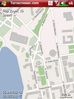
· Terracrosser uses zoomable maps
· Terracrosser is completely compatible with Google Maps service. With included Mapper module you can download maps from the Internet. All maps are automatically calibrated (geo-referenced)
What's New in This Release:
Terracrosser:
· POI system
· enhanced scrolling
· multiple options in settings menu
· maps correction to improve default maps calibration
Mapper:
· limited region to download non-square part of map
Like it? Share with your friends!
If you got an error while installing Themes, Software or Games, please, read FAQ.
Supported operating systems:
Windows Mobile 5.0, Windows Mobile 5.0 Smartphone, Windows Mobile 6 Classic, Windows Mobile 6 Professional, Windows Mobile 6 Standard, Windows Mobile 6.1 Classic, Windows Mobile 6.1 Professional, Windows Mobile 6.1 Standard, Windows Mobile 6.5 Professional, Windows Mobile 6.5 Standard
Wayfinder Earth (Pocket PC) Wayfinder Earth (Pocket PC) - The world in your hand! Welcome to the ultimate experience of discovering the earth on your mobile phone, for free…
How does it all work?
It's simple. Wayfinder Earth presents you with a 3D globe representing the planet earth, visible on the display of your mobile phone
TravelGoogles TravelGoogles allows you to search and view 5,451 local businesses and services sorted from local distance from your home settings. Set your home location in the settings box and tap on a service on the list to view local listings. The business directory service is provided by Google
amAze (Sony Ericsson) AmAze is a first of its kind free navigation and local search service. It is free to download and use and it contains wide coverage of maps including aerial photo in Europe, North America, Australia and parts of Asia and Africa
GPSed Pocket PC GPSed - Record GPS tracks from your mobile and trace them on a map.
Record tracks of your trips anywhere on the Earth from your mobile device. Tracks are traced on Google Maps and stored in an online archive. All you need to start tracking is a mobile device with the internal or external GPS receiver
LittleWays LittleWays - LittleWays is a simple route calculator for subways, tramways, bus lines and rapid train railways.
Using LittleWays you can provide start and end station and LittleWays will calculate all possible ways and displays them in a list. It's your choice which way you use. After selecting a route it will be displayed as a bold red line
Edinburgh Pocket A-Z map Edinburgh Pocket A-Z map - This publication has been designed for a Windows® Mobile-based Pocket PC (version 2002 or later) and The Pocket A-Z Viewer (included)
Travel Hamburg, Germany - Illustrated Guide, Phrasebook and Maps. FREE general info, map in trial Travel Hamburg, Germany - Illustrated Guide, Phrasebook and Maps. FREE general info, map in trial - An illustrated city guide, phrasebook, and maps. Indulge Yourself with a personal tour guide on Your PDA. FREE General chapter, basic phrasebook, and a map in the trial version.
Features
Fully illustrated.
Historical overviews
Other Software by developer «Nitisara»:
not found
Comments on Terracrosser:
Comments not found
If you noted an error or download link is broken, please, report it via this page or use comments.
Terracrosser is compatible with your device UBiQUiO 501


![USA-MI [Michigan] Map for EagleEye PDA Tracking System](https://static.mobyware.org/data/images/def_program_reduced.png "USA-MI [Michigan] Map for EagleEye PDA Tracking System")
")

")


