Phone2GEarth S60 converts GPS data directly to Google Earth® KML files.
Phone2Gearth is an easy Nokia Series 60 GPS aplication that allows to log tracks which are directly saved as Google Earth KML files.
New and usefull features like (Version 1.08):
- English, Spanish, German and French languages.
- Placemarks supported with timestamps in the track.
- bluetooth autostart, for easy use.
- Complete Series 60 supported. New models included. N90, 6680, 6670, 3230.. etc.
- Color and phone name configurable. it allows deference phones, tracks etc.
Easy 4-step Process
Set GPS Bluetooth:
In the Settings Menu you can choose "Set GPS", you will find the GPS automatically. If you use Bluetooth GPS, it might be necessary to activate Bluetooth before clicking "Set GPS".
Start capture LOG:
After having selected the GPS, click "Start" and your paths are used to log tracks.. On the top of the screen you can see the number of records and the number of satellites fixed. Select "Stop" for stoping the logged.
Export to Google Earth:
The Export menu allows choosing the destination (via bluetooth or via file) and generate the KML file.
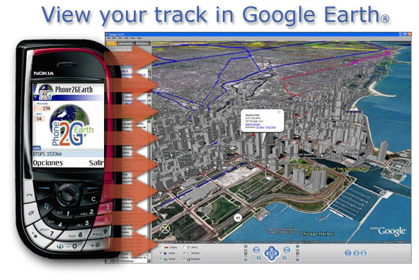
View your Track in Google Earth:
You have to transfer the file to your PC. By double clicking the KML file, Google Earth opens and displays the track.
Like it? Share with your friends!
If you got an error while installing Themes, Software or Games, please, read FAQ.
PyPOIAlert PyPOIAlert is a POI (Points of Interest) alerter.
Installation notes:
Install all sis-files on c:
* Install Python for S60
* Sign the following files:
-> locationrequestor_3rd.sis
-> envy_3rd_1_0_4_unsigned.sis
-> PyPOIAlert_v0_5_2_unsigned.sis
* Install the above sis-files on C:
Using PyPOIAlert:
- Start PyPOIAlert from your programs folder
NDrive Navigation NDrive Navigation turns your phone into A FULLY FUNCTIONING GPS NAVIGATION DEVICE w/on-board complete maps downloaded and stored on mobile device - ready to use in the car or outdoors. WORKS WITHOUT NW COVERAGE/WIFI
GETrack GETrack - Now you can record tracking data from your bluetooth GPS receiver and send the track via bluetooth to your PC for direct use with "Google Earth". For business, holidays and fun.
There's no need for any conversion software on the PC side. The tracking data is ready to be used with "Google Earth"
FON Access Points for Singapore FON Access Points for Singapore - FON offers you a new Points of Interest service (POIs). This allows you to download FONspots directly to your navigation device.
What does that mean? You can download a Points of Interest file directly to your navigation device
FON Access Points for Israel FON Access Points for Israel - FON offers you a new Points of Interest service (POIs). This allows you to download FONspots directly to your navigation device.
What does that mean? You can download a Points of Interest file directly to your navigation device
Navimote Navimote is an on-demand mobile phone-finder based on push technology. With Navimote you can enable others to retrieve your position in real-time
GeoLocateUK GeoLocateUK - Track Locate and Position across UK with GeoLocateUK
Now you can track another compatible Symbian smart phone across the UK as long as the tracked phone is linked to a blue tooth GPS receiver. It is as simple as switching on the GeolocateUK program on your phone and sending a position request to the remote phone
Other Software by developer «CYMONLINE»:
Phone2GEarth S80 Phone2GEarth S80 converts GPS data directly to Google Earth® KML files.
Phone2Gearth is an easy Nokia Series 80 GPS aplication that allows to log tracks which are directly saved as Google Earth KML files.
New and usefull features like (Version 1.08):
- English, Spanish, German and French languages.
- Placemarks supported with timestamps in the track
REALTRACK MOBILE POCKETPC Fleet Management and mobile devices tracking Comprehensive System, which allow the user to remotely track any person or object carrying a mobile device of the PDA


_programView.jpg)


