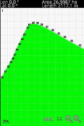
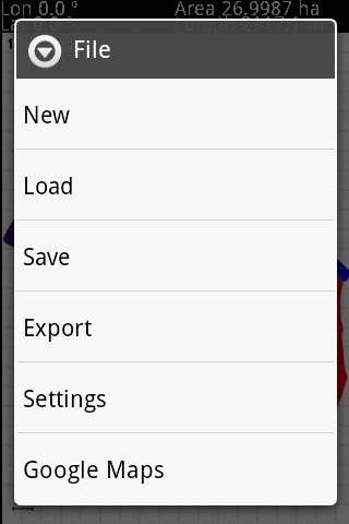
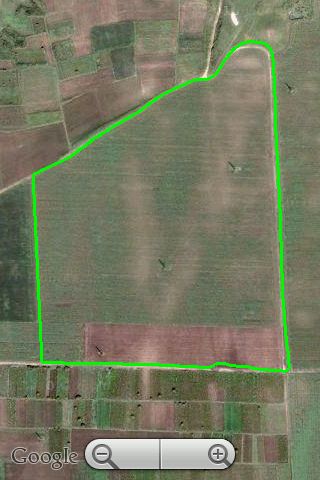
GPS Area Calculation - This program allows you to measure areas of any size, with a precision marked by your own GPS. The larger the area, the better the measure. The perfect tool for field and farm work.
Like it? Share with your friends!
If you got an error while installing Themes, Software or Games, please, read FAQ.
GeoLocateDE GeoLocateDE comes with an onboard population center map of 75000 suburbs, towns and cities of Germany. GeoLocateDE allows you to accurately track any vehicle or person carrying a Symbian S60 phone with GeoLocateDE running and connected to a Blue Tooth GPS receiver. You can set tracked contacts with password and then remotely monitor the location of users / vehicles
GETrack GETrack - Now you can record tracking data from your bluetooth GPS receiver and send the track via bluetooth to your PC for direct use with "Google Earth". For business, holidays and fun.
There's no need for any conversion software on the PC side. The tracking data is ready to be used with "Google Earth"
FON Access Points for Cyprus FON Access Points for Cyprus - FON offers you a new Points of Interest service (POIs). This allows you to download FONspots directly to your navigation device.
What does that mean? You can download a Points of Interest file directly to your navigation device
ILeSpeedCam ILeSpeedCam - This Speed Camera Alarm script:
* example of; net, GPS, graphics, audio, topwindow, geo-distance-math http://www.ga.gov.au/geodesy/datums/distance.jsp
* alarms when you are closer than 500 m of a speed cam
* speed camera coordinates are downloaded from a public POI-database http://www.gps-waypoints
Locator Locator-
This demo sends the location of the mobile phone to our server (gsm cell identifier or gps information - latitude and longitude). It connects automatically to our server using a predefined GPRS connection, at predefined time periods.
A Bluetooth-capable GPS device is required if you want to send gps information (e.g
FON Access Points for Taiwan FON Access Points for Taiwan - FON offers you a new Points of Interest service (POIs). This allows you to download FONspots directly to your navigation device.
What does that mean? You can download a Points of Interest file directly to your navigation device
Navizon for Symbian 3rd edition Navizon is the perfect urban companion for your handheld. It allows you to find cool places around you (such as bars, restaurants etc...), see where your friends are and find your own directions
Users with a GPS device can use Navizon worldwide. And Navizon will allow you to get a GPS fix where you couldn't before (indoors, urban canyons etc..
GETrack GETrack - Now you can record tracking data from your bluetooth GPS receiver and send the track via bluetooth to your PC for direct use with "Google Earth". For business, holidays and fun.
There's no need for any conversion software on the PC side. The tracking data is ready to be used with "Google Earth"
GPSXC GPSXC is a powerful GPS navigation and track logger software aimed at fulfilling the needs of people practicing open air sports including trekking, hiking, geocaching, MTB, paragliding, hanggliding, and sailing. Map support is now included! Maps can be imported and calibrated or just downloaded from a list of supported Internet sites
Comments on GPS Area Calculation:
Comments not found
If you noted an error or download link is broken, please, report it via this page or use comments.
Please, select device to check if GPS Area Calculation supports it