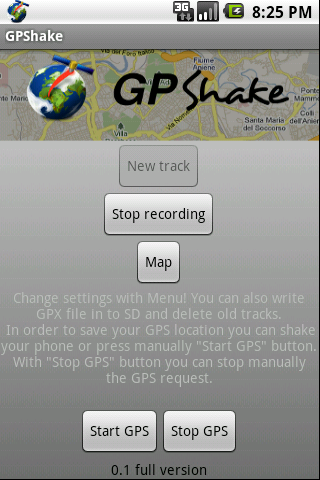
With GPShake you can track your GPS location, create GPX files, whenever you want with a shake of your phone! This means battery life saving! A great usage example could be when you want to geotagging your photo made with an external camera.
Full version:
-More than 5 GPS points
-Led notification
-Start/Stop GPS
-No ads
Like it? Share with your friends!
Supported operating systems:
Google Android 1.0, Google Android 1.5, Google Android 1.6, Google Android 10.x, Google Android 2.0, Google Android 2.1, Google Android 2.2, Google Android 2.3, Google Android 3.0, Google Android 3.1, Google Android 3.2, Google Android 4.0, Google Android 4.1, Google Android 4.2, Google Android 4.3, Google Android 4.4, Google Android 5.x, Google Android 6.x, Google Android 7.x, Google Android 8.x, Google Android 9.x
Similar Software:
NAVIGON USA & Canada for Android NAVIGON USA & Canada for Android - NAVIGON turns your mobile device into a fully featured GPS navigation system. The software provides advanced functionality for both drivers and pedestrians, including 2D and 3D maps, route planner, speed assistant, voice directions, local search, and more
LAS MobileTracker LT LAS MobileTracker LT - The LAS MobileTracker LT is an easily configured app to read GPS coordinates from an Android OS phone or tablet. Every five minutes, the coordinates and user ID are uploaded to our website from anywhere on the planet that has internet access. A GeoTag button also takes a ''snapshot'' of your location
GPS: Speed Pro GPS: Speed Pro - is a satellite navigation system tracking the speed of your vehicle on certain areas of your route. You can set a parameter which will display avarage speed of the trip. The utility controls maximum allowed speed mode and will notify in case of its breach
amAze (LG) AmAze is a first of its kind free navigation and local search service. It is free to download and use and it contains wide coverage of maps including aerial photo in Europe, North America, Australia and parts of Asia and Africa
Android Photo GeoTag Android Photo GeoTag - Take pictures with your mobile phone and incorporate the data of the geographical location. The application allows you to include in the photographs, data from the GPS receiver, along with a brief note. If you know the coordinates, not having the GPS receiver, you can also handwrite geographic data
Maps In My Pocket (MIMP) Maps In My Pocket - The main goal of this application is to allow its users to view maps, locate themselves, follow KML or GPX formatted tracks and getting directions from place to place.
What's New in This Release:
· New Icon
What's New in 1.4.3:
· Long press and long pinch concurrency on info bubble solved
VGPS (Vietnamese GPS) for Android VGPS (Vietnamese GPS) for Android was designed to use city street map on your ordinary mobile phone without the need of having GPS receiver or internet connection. VGPS does not require internal or external GPS receiver. However, if you have internal GPS receiver or external bluetooth GPS receiver, VGPS can work with your GPS receiver as well
NAVIGON MobileNavigator NAVIGON MobileNavigator - Turn your Android phone into a mobile navigation device with lots of useful functions that will delight you! The pocket navigation device will show you the right way with functions such as Reality View Pro and Lane Assistant Pro
Other Software by developer «Lorenzo Braghetto»:
BatteryDiffWidget BatteryDiffWidget is Android widget shows you in home page the estimated battery lifetime in hours:minutes according to battery consumption and time

")


")

")
 for Android")

