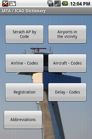
IATA / ICAO Dictionary -This application is an offline database for IATA / ICAO airport, airline, aircraft, delay codes and aircraft registration codes.
The airport database provides:
- Name
- Elevation
- Latitude and Longitude coordinates,
- timezone,
- runway and communication information (not every airport)
- Metar / TAF reports (not every airport)
- google map (not every airport)
- sunrise / set calculation
- find other airport in the vicinity of the selected airport or from your present position (GPS required)
- calculate the distance to the selected airport (GPS required)
The airline database provides:
- Name
- Country
- Callsign
- picture of the airline with airliners.net
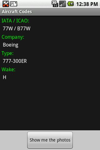
The aircraft database provides:
- Company
- Type
- wake category
- picture of the aircraft with airliners.net
Other functions are:
AC registrations; selection by
- country - registration
- registration - country
Delay codes
general aviation abbreviations
Like it? Share with your friends!
Supported operating systems:
Google Android 1.5, Google Android 1.6, Google Android 10.x, Google Android 2.0, Google Android 2.1, Google Android 2.2, Google Android 2.3, Google Android 3.0, Google Android 3.1, Google Android 3.2, Google Android 4.0, Google Android 4.1, Google Android 4.2, Google Android 4.3, Google Android 4.4, Google Android 5.x, Google Android 6.x, Google Android 7.x, Google Android 8.x, Google Android 9.x
Similar Software:
Ankara Rehberi Restoranların, otellerin, eğlence yerlerinin, alışveriş merkezlerinin, hastanelerin, belediyelerin iletişim bilgilerinin yanı sıra harita destekli adreslerinin de yer aldığı bu uygulama ile hastanelerin de randevu sistemlerine direk ulaşabilirsiniz
Istanbul Metro Istanbul Metro - Yolda zaman kaybını önleyen çağımızın gereği metroyu bu uygulamayla daha da hızlandırdık
BHTrans Cameras BHTrans Cameras is an Android application which displays traffic camera images from BHTrans in Belo Horizonte, Brazil. You can pick the camera you wish to see from a list or a map, or you can just ask for the camera closest to you
EncountMe (Android) EncountMe - With EncountMe, your walk will never be the same. In background mode, EncountMe will record all your encounters with users who have the same application. You can enjoy viewing some of your encounters while commuting, or when you come back home and just about to rest. Lots of possible stories and scenarios
OneBusAway Real-time transit information for the Puget Sound region and beyond. Never miss the bus again! OneBusAway gives you real-time arrival information for Seattle area buses, including King County Metro, Sound Transit, and Pierce Transit
Hong Kong Transport Hong Kong Transport - Hong Kong Transport App provides a useful guide for you to go around Hong Kong streets by public transport
KAYAK Lite KAYAK Lite Flight, Hotel, Car Search plus Flight Tracker. FREE.
If you need quick access to KAYAK travel search functions, this is the app for you.
Flight Search - find the best flight options for your trip.
Hotel Search - get the hotel that is right for you: 5-star or budget, we'll find it
indian rail train PNR and hotels indian rail train PNR and hotels - Official ixigo indian rail app recommended by Google CEO, Sundar Pichai
Venice Hotels Search Venice Hotels Search Book Cheap Venice Hotels. Save Up to 80% Venice City Hotels The world's largest hotel search engine that combines all hotel deals from the best travel sites into one free, quick and easy search. Genius!
Other Software by developer «Steve Dexter»:
Snowtam Decoder Snowtam Decoder - You have a snowtam in the metar report, you want to decode. Snowtam Decoder does it for you.
· Decoding of a snowtam in metar format
· Explanation of the items (A ,B , C, ..
Aviation Weather with Decoder Aviation Weather with Decoder - An easy way to receive metar and TAF reports from NOAA
Guess the X Guess the X - With this game you can guess a flag, a capital, a land and boundaries.
There are four input methods available to enter the answer: an autocomplete editbox, via a listview, multiple choice and a tap mode.
There are also options to change the color, size and font

")


")


