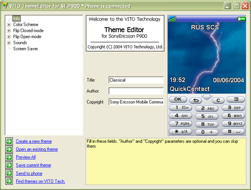
VITO ThemeEditor - FREE for non-commercial use PC-based application that allows you to create your own themes for using on the P900. Start with basic settings, such as defining a default color scheme, then set backgrounds for every screen element, and finish your masterpiece with creating advanced masks and image patterns. Every setting is optional, and you can skip any step.
Variety of settings for both Flip Open and Flip Closed modes, options for editing sounds and screen saver bring endless opportunities to customize your P900.
Created themes can be saved as a single file and transferred to the P900 or exchanged with your friends and other people.
This application is free for non-commercial use. If you want to offer your themes as commercial products, you have to purchase the commercial licence.
Like it? Share with your friends!
If you got an error while installing Themes, Software or Games, please, read FAQ.
Supported operating systems:
UIQ 2.0
Similar Software:
Magic Themes for P800 Magic Themes - With Magic Themes, your old Sony Ericsson P800 will look like a new P900, because now you can use P900 themes (UTZ files) right on the device! This sounds unbelievable, but it is.
Magic Themes is a useful utility that allows you to change almost everything on your smartphone
Other Software by developer «VITO Technology»:
Map of Poland Map of Poland - A map of Poland. Good for intercity travels with SmartMap.
Layers include:
Towns
Settlements
Airports
Roads
Railroads
Rivers
Inland water
Administrative borders
International borders
Trees
Map scale is 1:1 million.
Good for use with any version of SmartMap. SmartMap can be purchased here
Map of South Korea Map of South Korea - A map of South Korea. Good for intercity travels with SmartMap.
Layers include:
Towns
Settlements
Airports
Roads
Railroads
Rivers
Inland water
Administrative borders
International borders
Trees
Map scale is 1:1 million.
Good for use with any version of SmartMap
Map of Sri Lanka Map of Sri Lanka - A map of Sri Lanka. Good for intercity travels with SmartMap.
Layers include:
Towns
Settlements
Airports
Roads
Railroads
Rivers
Inland water
Administrative borders
International borders
Trees
Map scale is 1:1 million.
Good for use with any version of SmartMap. SmartMap can be purchased here
Map of Trinidad and Tobago Map of Trinidad and Tobago - A map of Trinidad and Tobago. Good for intercity travels with SmartMap.
Layers include:
Towns
Settlements
Airports
Roads
Railroads
Rivers
Inland water
Administrative borders
International borders
Trees
Map scale is 1:1 million.
Good for use with any version of SmartMap
Map of Thailand Map of Thailand - A map of Thailand, divided into 72 smaller territories for the ease of use. Good for intercity travels with SmartMap.
Layers include: Towns - Settlements - Airports - Roads - Railroads - Rivers - Inland water - Administrative borders - International borders - Trees. Map scale is 1:1 million.
Good for use with any version of SmartMap
Map of Portugal Map of Portugal - A map of Portugal, divided into 3 smaller territories for the ease of use.
CONTINENTAL PORTUGAL
MADEIRA (ISLANDS)
AZORES (ISLANDS)
Good for intercity travels with SmartMap
Map of North Dakota (US State) Map of North Dakota (US State) - A map of the North Dakota by VITO Technology. Good for intercity travels with SmartMap.
SmartMap is a mobile device application which uses vector and raster maps. It is compatible with any NMEA protocol GPS receiver (Compact Flash socket, serial port, BlueTooth or sleeve)
Family Doctor Family Doctor is a quick-reference health guide to your symptoms and how to deal with them - based on the well-known and time-tested medical tips of Home Medical Adviser.
Try the simple “yes&no” Q&A charts that will take you through your symptoms and will give you approved guidelines about what to do for your headaches or for your baby tummy ache
VITO AudioPlayer VITO AudioPlayer-This easy-to-use application runs swiftly and has the basic playback features.
Full MP3, Ogg, WAV support
Map of Romania Map of Romania - A map of Romania. Good for intercity travels with SmartMap.
Layers include:
Towns
Settlements
Airports
Roads
Railroads
Rivers
Inland water
Administrative borders
International borders
Trees
Map scale is 1:1 million.
Good for use with any version of SmartMap. SmartMap can be purchased here


")


