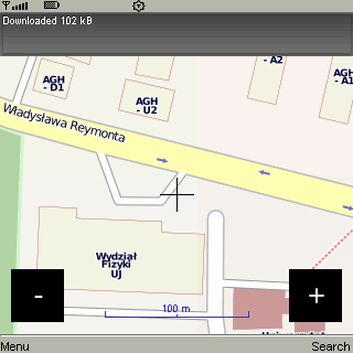
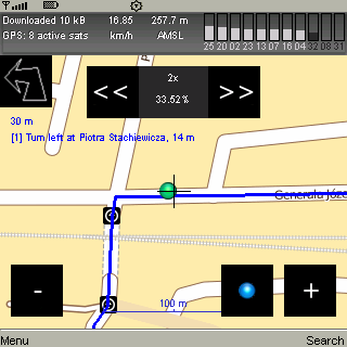
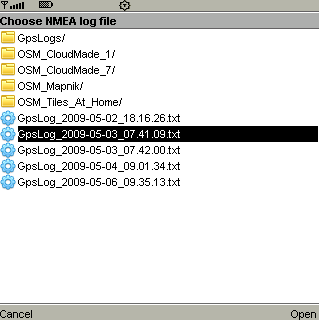
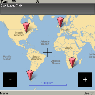
CloudGPS is Java ME mapping application using OpenStreetMap data and CloudMade services to provide.
· view different maps with panning and zooming
· use GPS (internal, bluetooth) to show current position
· find objects by name
· find route between two points
· route to destination using turn-by-turn instructions
· record and replay NMEA
· caching tiles without artificial limits
Like it? Share with your friends!
Requirements:· MIDP 2.0, CLDC 1.0
Supported operating systems:
Java ME, Java Nokia 240x320, Java SE 240x320
Similar Software:
SportyPal (Java) SportyPal is an easy to use intuitive application for your mobile device. You activate it when you start your running, cycling, walking, rollerblading or similar exercise. In two simple clicks it will start to log and map your position, movement, distance, tempo and calories burned
GpsMid Indonesia GpsMid is a free, fully offline, vector based map application for your mobile phone. It displays your current position on a zoomable map and can be used to search for and navigate to roads or points of interest of your liking. As all data is stored in a compact binary format on your mobile phone you will incur no charges for extra data downloads
FON Access Points for Singapore FON Access Points for Singapore - FON offers you a new Points of Interest service (POIs). This allows you to download FONspots directly to your navigation device.
What does that mean? You can download a Points of Interest file directly to your navigation device
Moving GPS Map / InFlight Moving GPS Map / InFlight - A Moving GPS Map and 3D GPS Logger for your handheld. It can use either an internal GPS (such as in the Nokia N95 or E90) or connect to an external Bluetooth GPS receiver or the HGE-100 from SonyEricsson. One can draw own vector-maps and -paths in Google-Earth and export them to the device. 3D GPS logs can be exported and viewed in Google-Earth
TrackMeTweet TrackMeTweet - uses the built-in GPS, or a Bluetooth GPS (recommended for cellphone battery life) to send regular tweets of your location to Twitter.
The Tweet info contains your identifier, distance from take-off in km, coordinates in degrees and decimal minutes, altitude in meters above sea level, speed in km/h, direction you are heading at that specific moment
Aloqa (Java) Aloqa is a push based mobile service that proactively notifies you about interesting POIs, events and services around you. Last.fm concerts, movies and cinemas including show times, nightlife events, clubs, restaurants, fast food, ATMs, Starbucks, tourist sights, wikipedia, wifi hotspots, geo caching, weather and many more
FON Access Points for North Korea FON Access Points for North Korea - FON offers you a new Points of Interest service (POIs). This allows you to download FONspots directly to your navigation device.
What does that mean? You can download a Points of Interest file directly to your navigation device
FON Access Points for Vietnam FON Access Points for Vietnam - FON offers you a new Points of Interest service (POIs). This allows you to download FONspots directly to your navigation device.
What does that mean? You can download a Points of Interest file directly to your navigation device
amAze (Sonim) AmAze is a first of its kind free navigation and local search service. It is free to download and use and it contains wide coverage of maps including aerial photo in Europe, North America, Australia and parts of Asia and Africa
Redpin The aim of the Redpin project is to create an open source system that allows indoor positioning up to room-level description using mobile phones
Other Software by developer «Damian Waradzyn»:
not found
Comments on CloudGPS:
Comments not found
If you noted an error or download link is broken, please, report it via this page or use comments.
CloudGPS is compatible with your device Samsung C3222


")


")


")
