PrettyMap Full - View maps of Earth and other planets with PrettyMap! See current day and night areas, learn geography with the quiz, enjoy 3D elevation surfaces, measure distances between locations and create your own maps with special places! PrettyMap lets you view vector and raster maps and images (such as country boundaries, world cities, rivers, satellite photos), search in geographically-referenced data, visualize and analyze spatial information, extend your knowledge, and edit your own simple maps. PrettyMap is a GIS program with the following features:
support for vector maps (points, lines, areas)
support for raster maps (terrain elevation and bathymetry, images, symbolic)
handles multi-attribute data associated with vector map objects
displays maps of various planets
free maps available:
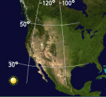
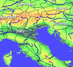
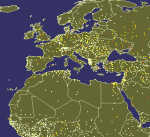
political: country boundaries with country names, capitals, population sizes, ...
major cities with names, status, population ranks and classes, ...
USA states with areas, population sizes, males, females, age, marriage, race, and household statistics, ...
major rivers
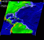
elevation data for Earth, Moon, Mars
and many more!
internet connection not required on your PDA
various color schemes for elevation maps
user-defined elevation colors
zoom range from whole planet to meters
shows day and night area, computes shadow length and sun/north orientation
multiple, configurable vector map layers
data search for vector map databases
versatile quiz with teacher mode for vector map databases
bar charts and color-by option for numeric features in vector map databases
relief and 3D elevation (DEM) view with vector map overlay
distance measurement
integrated user-defined locations (Points Of Interest) editor, stores notes and values for each POI
sessions to quickly save/restore program state
adjustable water level for elevation data
numerous settings to customize the program
Try before you buy! PrettyMap is a shareware with a 30-day evaluation period, then you have to register.
· 30 days trial
· smaller area where maps are displayed
· automatically exits after a few minutes of using PrettyMap
· the quiz limited to 6 questions
· no spheral elevation relief view
· no online weather reports and forecasts for user-defined locations
· user locations editor limited to 5 points per map; one user map open at a time
· inactive "containing" option in vector data search
What's New in This Release:
· slightly faster displaying of vector maps
· fixed drawing of some vector maps: objects are now again sorted by importance (this was a bug since v5.3)
· improved default color styles for labels on vector area maps
· usability enhancements
Like it? Share with your friends!
Supported operating systems:
Palm OS 5.x
Other Software by developer «Maciej Komosinski»:
PrettyEarth PrettyEarth
View maps of Earth with PrettyEarth! See current day and night regions, learn geography by taking the quiz, enjoy relief elevation surfaces and measure distances between locations
Europe Elevation Maps Europe Elevation Maps - This free pack contains high resolution elevation map for Europe, divided into 2 smaller pieces. Each tile covers the projected area of 40°x50°, and contains almost 29 million of samples (one sample per square kilometer).
51 countries lie in the area covered by this pack
PrettyMap Basic View maps of Earth and other planets with PrettyMap! See day and night areas, learn geography, enjoy 3D elevation surfaces, measure distances and create your own maps with special places!
Vector Maps for PrettyMap Vector Maps for PrettyMap - This pack contains the most popular vector maps for PrettyMap
Little Sailor (Palm OS) Little Sailor (Palm OS) - Little Sailor is a sailing, surfing and motorboat simulator for mobile devices. Take Little Sailor with you and learn basics of sailing anywhere! See how wind force affects the sail and test your skills against AI opponents in a yacht race. Learn how to trim the sails to make the most use of wind energy. Discover when there is a risk of capsizing
Little Sailor (iPhone/iPad) Little Sailor (iPhone/iPad) - Little Sailor is a highly realistic sailing and motorboat simulator. Take Little Sailor with you and learn basics of sailing! See how wind force affects the sail and test your skills against AI opponents in a yacht race. Learn how to trim the sails to make the most use of wind energy. Discover when there is a risk of capsizing
PrettyMap View maps of Earth and other planets with PrettyMap! See current day and night areas, learn geography with the quiz, enjoy 3D elevation relief, measure distances, edit locations!
Free Earth Elevation Map for PrettyMap/PrettyEarth Earth Elevation Map for PrettyMap/PrettyEarth - This is a medium-resolution, free Earth elevation map for PrettyMap and PrettyEarth. It contains one elevation sample per 4 km, approximately.
Note: large file (16 MB download, 55 MB after installing).
Note for PrettyEarth users: this map will be installed to Program FilesPrettyMapmaps
Little Sailor: sailing, surfing and motorboat simulator Little Sailor
Take Little Sailor with you and learn basics of sailing! See how wind force affects the sail and test your skills against AI opponents in a yacht race. Learn how to trim the sails to make the most use of wind energy


")
")


