PrettyMap Basic - View maps of Earth and other planets with PrettyMap! See current day and night areas, learn geography with the quiz, enjoy 3D elevation surfaces, measure distances between locations and create your own maps with special places! PrettyMap lets you view vector and raster maps and images (such as country boundaries, world cities, rivers, satellite photos), search in geographically-referenced data, visualize and analyze spatial information, extend your knowledge, and edit your own simple maps. PrettyMap is a GIS program with the following features:
support for vector maps (points, lines, areas)
support for raster maps (terrain elevation and bathymetry, images, symbolic)
handles multi-attribute data associated with vector map objects
displays maps of various planets
free maps available:
country boundaries with country names, capitals, population sizes, ...
major cities with names, status, population ranks and classes, ...
USA states with areas, population sizes, males, females, age, marriage, race, and household statistics, ...
major rivers
elevation data for Earth, Moon, Mars
and many more!
internet connection not required on your PDA
various color schemes for elevation maps
user-defined elevation colors
zoom range from whole planet to meters
shows day and night area, computes shadow length and sun/north orientation
multiple, configurable vector map layers
data search for vector map databases
versatile quiz with teacher mode for vector map databases
bar charts and color-by option for numeric features in vector map databases
relief and 3D elevation (DEM) view with vector map overlay
distance measurement
integrated user-defined locations (Points Of Interest) editor, stores notes and values for each POI
sessions to quickly save/restore program state
adjustable water level for elevation data
numerous settings to customize the program
Try before you buy! PrettyMap is a shareware with a 30-day evaluation period, then you have to register.
Registered PrettyMap Basic has the following limitations:
the quiz is limited to 20 questions
user locations editor is limited to 20 points per map; one user map open at a time
inactive "containing" option in vector data search.
· 30 days trial
· the quiz is limited to 20 questions
· no spheral elevation relief view
· no online weather reports and forecasts for user-defined locations
· user locations editor is limited to 20 points per map; one user map open at a time
· inactive "containing" option in vector data search
What's New in This Release:
· slightly faster displaying of vector maps
· fixed drawing of some vector maps: objects are now again sorted by importance (this was a bug since v5.3)
· improved default color styles for labels on vector area maps
· usability enhancements
MetrO (PPC) Metro helps you find your way in the public transport systems (subway, bus, trams, ...) in more than 4000 cities around the world. FREE, FAST & ACCURATE. Simply enter you start and end stops, hit the "Go" button and the program finds the fastest route
Travel Galicia, Spain for Palm OS Travel Galicia, Spain for Palm OS - An illustrated guide, phrasebook, and maps. Indulge Yourself with a personal tour guide on Your PDA
Travel Saudi Arabia (Palm OS) Travel Saudi Arabia (Palm OS) - An illustrated travel guide, phrasebook, and maps. Indulge Yourself with a personal tour guide on Your PDA
KMaps KMaps allows users to get maps and directions, find local businesses, post and search user profiles and create their own location aware content to share with the community.
In addition, KMaps provides a free web 2.0 API for software developers to create KMaps add-ons
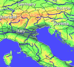
BRDMap BRDMap - Interactive map of Germany with informations about the German states and their capitals.
English and German version included.
· Graphic selection State - Tapping a federal country in the map: Land is marked and the name of the Federal Lands and the state capital appears
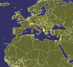
World Atlas for HandMap World Atlas for HandMap - A handy world atlas for your Palm.
Features detailed map of the world, with zoom. Shows land, water, population centers and international borders. Over 3,000 city centers included!
Search for a city or country by name, or calculate distances
Travel Hawaii (Palm) Travel Hawaii (Palm) - illustrated guide, phrasebook, and maps. Including Honolulu, Hilo, National Parks.
An illustrated travel guide, phrasebook, and maps. Indulge Yourself with a personal tour guide on Your PDA. FREE General Information in the trial version
Travel Stockholm, Sweden (Palm OS) Travel Stockholm, Sweden (Palm OS) - An illustrated city guide and maps. Indulge Yourself with a personal tour guide on Your PDA
PrettyMap View maps of Earth and other planets with PrettyMap! See current day and night areas, learn geography with the quiz, enjoy 3D elevation relief, measure distances, edit locations!
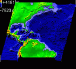
Free Earth Elevation Map for PrettyMap/PrettyEarth Earth Elevation Map for PrettyMap/PrettyEarth - This is a medium-resolution, free Earth elevation map for PrettyMap and PrettyEarth. It contains one elevation sample per 4 km, approximately.
Note: large file (16 MB download, 55 MB after installing).
Note for PrettyEarth users: this map will be installed to Program FilesPrettyMapmaps
Vector Maps for PrettyMap Vector Maps for PrettyMap - This pack contains the most popular vector maps for PrettyMap
Little Sailor (iPhone/iPad) Little Sailor (iPhone/iPad) - Little Sailor is a highly realistic sailing and motorboat simulator. Take Little Sailor with you and learn basics of sailing! See how wind force affects the sail and test your skills against AI opponents in a yacht race. Learn how to trim the sails to make the most use of wind energy. Discover when there is a risk of capsizing
PrettyEarth PrettyEarth
View maps of Earth with PrettyEarth! See current day and night regions, learn geography by taking the quiz, enjoy relief elevation surfaces and measure distances between locations
Little Sailor: sailboat, surfing and motorboat simulator Little Sailor
Take Little Sailor with you and learn basics of sailing! See how wind force affects the sail and test your skills against AI opponents in a yacht race. Learn how to trim the sails to make the most use of wind energy


")


")


")
")


")


