eFAD is the most powerful (multi-platform) electronic airport guide on earth. eFAD provides complete airport information, weather, and more from your connected PC, Mac, PDA and/or (XHTML) mobile phone. eFAD can also be taken off-line with eFAD2Go.
For less than $7 per month eFAD provides detailed U.S. airport and NAVAID information (public, private, fly-in communities & airparks), runways, LAHSO, ILS, and PCN notes, ATCT (hours & phone), weather (METAR/TAF, Winds Aloft, & PIREPs with decoding, NEXRAD, 25+ weather charts, AIRMETS/SIGMETS, RVR, Personal Weather Stations (PWS), NWS forecast), FBOs, Repair Stations, Parachute Jumping Areas (PJA), FSDOs, NOTAMs, FSS, TFRs (text & graphical), STMPs, SUA (MOAs), sun & moon information, FAA airport status, airline service & other operations, NTSB reports, tail numbers, 13,000+ approach charts & diagrams, user created comments, direct web-links to airport websites, E6-B, aviation dictionary (6,000+ terms), Federal Aviation Regulations (FARs), traffic statistics, location maps, enroute radio stations, airshows and airport news, travel information (tourist information, taxi, rental cars, hotels, motels, and restaurants) and much more. For those who prefer paper or don't have a Personal Digital Assistant (PDA), eFAD can also print kneeboard reports.
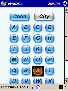
eFAD2Go (free to all current subscribers) is a powerful stand-alone extension of the eFAD service. With eFAD2Go and iSilo you can take every (5,260+) public U.S. airport with you on your PC, Tablet PC, PDA or mobile phone (no wireless connection needed).
Detailed U.S. airport information that is updated every 56 days. eFAD2Go includes: morse code, elevation, airport & city names, county, distance from city, latitude and longitude, magnetic variation, sectional, hours attended, ATCT status (hours & phone number), beacon, TPA, lighting hours, segmented circle, wind indicator, fuel, GA landing fees, nearby radio stations, airline service, airport size, and nearby NAVAIDs. We have also included direct dial numbers for FSS, ATCT, ARTCCs and weather services (ASOS/ATIS/AWOS). The program also provides you with detailed runway, runway obstacles and ILS information, airport comments, user created remarks, communications, and FBOs. eFAD2Go includes a reference section with Morse Code, Fuel Information, transponder codes, V-Speeds, VOTsand more. eFAD2Go also supports bookmarks (favorites), full screen mode, full-text searching, high-res devices, and memory cards.
Like it? Share with your friends!
Supported operating systems:
Palm OS 3.x, Palm OS 4.x, Palm OS 5.x
Similar Software:
WindCalc AA WindCalc AA - Here's is a version that I have customized for my own personal use.
It allows me to input the Headwind or Tailwind correction and the Runway Limited Weight from the TPS and calculate the corrected Runway Limited Weight based on the current winds. I've also included the wind limitations for the MD-80 for quick reference
Mileage Calculator Mileage Calculator - Easily track your fuel mileage every fillup without any effort or fiddling around.
This is a very simple Palm program designed for quick use at busy gas stations.
All you have to do is enter your current odometer reading and the gallons filled (it remembers the odometer reading from your previous fillup so you don't have to enter it)
EconoFuel EconoFuel - Looking to save money on fuel? This fabulously simple and effective tool calculates your fuel efficiency in terms of both mile per gallon (mpg) and mile per dollar (mpd). Entries are stored and are able to be viewed and modified. This tool will help you calculate and keep track of your fuel efficiency
AW Aircraft Terms and Abbreviations AW Aircraft Terms and Abbreviations - Aircraft Terms and Abbreviations.
320 words.
This dictionary contains the terms and abbreviations related to aircraft and flight.
This dictionary requires you have installed RoadLingua software, which is included to the archive
MileageLog MileageLog - Easy to Use
Easily track mileage. Convenient and simple to use. Enter date, description, miles and MileageLog calculates the running total. Very handy program!
Flexible and Functional
View all records at once with ability to delete, edit or add records at any time. Features pop-up date selector
Basic Model Airplane Proportions Basic Model Airplane Proportions (BMAP) is designed to calculate the data input for Engine CID, Model Weight, Wing Area, Wing Loading, Power Loading, Wing Root Chord, Wing Tip Chord, and Wing Span into measurements needed for model fabrication. All the above can be calculated based on related data entered or you can enter your own
WinterOPS WinterOPS is designed for the airline pilot flying in adverse winterly weather conditions.
The program allows you to quickly decode AFTN runway reports and to get operational corrections and limits for adverse runway conditions based on this runway report.
In addition a simple crosswind calculator is included.
WinterOPS runs on the Palm OS platform Version 2
AutoCalc for Palm OS AutoCalc for Palm OS - Tons of useful features for anyone who owns a car or is thinking about buying one!
AutoCalc Features:
Insurance database, including agent and claim numbers
AvLogbook AvLogbook is a program designed for the pilot who'd like to have their flying history at their fingertips, no matter where they are.
You can display the full list of log entries, sort them by several criteria, filter them to only see certain types (PIC, Dual, specific aircraft, airport etc.) or search the remark and note fields.
Total flight times, landings etc
Other Software by developer «Production Software»:
Quik Codes (QCodes) Quik Codes (QCodes) - Quik Codes (QCodes) is an application that is designed to assist travelers, travel agents, business people and others with a single resource for frequent travel codes.
Aircraft equipment codes, seating layouts, passengers and engines. Airline codes including: country, radio call-sign, phone, TDD and web address
Pilot Aviation Dictionary (PAD) Pilot Aviation Dictionary (PAD) - PAD is a powerful "must have" tool for pilots, military, controllers, CFIs and aviation enthusiasts, that provides a listing of the most common terms, acronyms and information related to aviation
Airport Codes (APCodes) Airport Codes (APCodes) is a complete listing of every "Public" airport in the United States (5900+) as well as 570+ of the most popular International airports from over 150 different countries
Airport Signs (AP Signs) Airport Signs (AP Signs) is an application that is designed to assist pilots and others involved in aviation with the common airport signs and markings.
Airport Signs is a very useful tool for training and review of airport signs including Surface Movement Guidance and Control System (SMGCS)


")
")


")
")
")
")
")