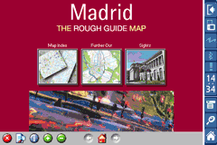
Rough Guides Map Madrid... These guides are a series of fantastic interactive maps.
Produced in conjunction with the premier travel publisher Rough Guides.
Discover and explore Madrid using full colour interactive linked maps, in this simple to use PDA version of The Rough Guides Madrid.
Find all the top tourist spots and key attractions with ease, information on the city and its sights can be quickly displayed with links to photographs and map locations. All in a superb easy to use interface.
If you''re travelling to Madrid, be sure you don''t leave home without this guide on your PDA.
The Rough Guide city maps includes:
Fully scrollable and interactive maps of the city.
Tap any location to display information and available links.
Intuitive navigation bar meaning you are never more than one click away from the information you require.
Map links allow you to directly link to other maps, photographs, or detailed views.
Categorised Find feature allowing you to quickly find any street, place of interest or station.
Categorised Information feature providing a wealth of information on the city, places of interest, etc.
1-Click Home feature, keeping the Home map always at hand.
Zoom function on all maps.
Hi Res & landscape displays supported.
Like it? Share with your friends!
If you got an error while installing Themes, Software or Games, please, read FAQ.
Supported operating systems:
Pocket PC 2002, Windows Mobile 2003, Windows Mobile 5.0, Windows Mobile 6 Classic, Windows Mobile 6 Professional, Windows Mobile 6.1 Classic, Windows Mobile 6.1 Professional, Windows Mobile 6.5 Professional
Similar Software:
BackCountry Navigator BackCountry Navigator is fun-filled navigation software for the outdoor adventurer. Use it in a variety of outdoor adventures, from kayak touring to geocaching. This is a summary of what you can do with the product.
BackCountry uses free topo and aerial maps for the United States, downloaded directly from Terraserver-USA
Leaf Locate Leaf Locate- Free location software for Windows Mobile
CartoType Demo (Windows Mobile) CartoType A simple map viewer using the CartoType library.
The program is installed in the folder My Device/Program Files/CartoType. Click on the CartoTypeDemo icon to run the program, then select Open Map.. from the menu to open a map. A map of Berlin is supplied as a sample.
Apart from the menu commands, you can zoom in by pressing the joystick or rolling ball
Map4Fun Taipei Map4Fun Taipei - Going to Taipei? just download it for free!
Attractions and shops/hotels/restaurants... in Taipei... find coupons/POI instant video/communication links...on hand, and much more of major Asian cities at Map4fun.
1. Taipei Information.
2. Useful numbers.
3. Tourist attraction.
4. East Taipei area map.
5. Jhonshan area map
MyTravelr Mytravelr is a set of tools designed to help on-the-go mobile users maximize their productivity and reduce the stress of trave.
1.0F3 version:
- Fixed bug: some cities DST issue.
- Fixed bug: Weather update from forecast screen.
- Added: Option for disabling Internet Network confirmation.
1.0F2 version:
- Added: Edit cities feature (Add/Update/Delete)
redBANG Shenzhen 18 TOP SIGHTS 2006 THE BEST MOBILE GRAPHICS YOU HAVE EVER SET YOUR EYES ON
This TOP 18 sights map contains all THE TOP locations at your finger tips. Simple and easy to use multi step zoom in & out function map as well as movement in any direction
HomeDirections HomeDirections - This program allows you to set your home location. You can then enter an address from home or to home and the program will give you directions. NOTE: You must be connected to the internet.
This program requires that you have both the 'BeanDLL.dll' file ** and ** the runtime files for Visual Basic on your PocketPC computer
Map of Tennessee (US State) Map of Tennessee (US State) - A map of the Tennessee by VITO Technology. Good for intercity travels with SmartMap.
SmartMap is a mobile device application which uses vector and raster maps. It is compatible with any NMEA protocol GPS receiver (Compact Flash socket, serial port, BlueTooth or sleeve)
Tube Rome (Series 60) Tube Rome (Series 60) - Our highly acclaimed Tube application that guides you around the metro & rail system of Rome is now available for your Series 60 Symbian powered phone. An essential addition to your phone for locals and tourists alike.
· A detailed clear colour map of the Rome metro & rail system fully scrollable.
· Quick find station utility
New York Subway for iPad by Zuti New York Subway for iPad by Zuti - The "New York Subway" application is a superb geographically based map and route planner for the New York public transport systems
Tube Munich (Palm OS) Tube Munich (Palm OS) - An award winning and highly acclaimed Palm OS application that guides you around the metro (S-Bahn / U-Bahn) system of Munich. An essential addition to your Palm device for locals and tourists alike.
Tube's features include:
A detailed clear colour (or grey scale) map of the transport system fully scrollable.
Quick find station utility
Tube 2 Seoul (Palm OS) Tube 2 Seoul (Palm OS) - This map package for Tube 2 consists of a fully scrollable detailed map of the Seoul Metropolitan Subway system.
Plan journeys on this system, list details of the quickest routes and see a superb animated display of your journey tracking around the system map
Tube 2 Chicago (UIQ) Tube 2 Chicago (UIQ) - This map package for Tube 2 consists of a fully scrollable detailed map of the Chicago metro & commuter rail system.
It includes the rapid transport system of subway and elevated lines, in addition to the many commuter rail lines. The map also indicates how the Amtrak intercity routes intersect with the cities transport network
Tube 2 San Francisco (Palm OS) Tube 2 San Francisco (Palm OS) - This map package for Tube 2 consists of a fully scrollable detailed map of the San Francisco metro & rail systems.
The maps in this package cover the BART, SCVTA & Caltrain systems plus the Municipal Metro, Municipal Historic Street Car and Cable Car systems in central SF
Tyne & Wear Metro for iPad by Zuti Tyne & Wear Metro for iPad by Zuti - The new Tyne & Wear Metro map makes it easy to travel in and around the city using the Nexus Metro system. Unlike old fashioned schematic style maps this product contains a geographically accurate central area showing major streets, parks and places of interest etc, allowing the user to easily get their bearings
Tube 2 Munich (UIQ3) Tube 2 Munich (UIQ3) - This map package for Tube 2 consists of a fully scrollable detailed map of the Munich metro, rail & tram system.
Plan journeys on this system, list details of the quickest routes and see a superb animated display of your journey tracking around the system map.
Munich is the capital city of Bavaria, the southern most German federal state
Tube 2 Washington (UIQ) Tube 2 Washington (UIQ) - This map package for Tube 2 consists of a fully scrollable detailed map of the Washington metro system.
Plan journeys on this system, list details of the quickest routes and see a superb animated display of your journey tracking around the system map
Tube London City Streets (2009 Edition) Tube London City Streets
This Tube package consists of a fully scrollable detailed map of the London Underground system and 9 linked GPS enabled A-Z street maps.
Plan journeys on the London Underground system, list details of the quickest routes and see a superb animated display of your journey tracking around the system map


 Hi Res & landscape displays supported.


")

")

")
")
")
")

")
")
")