Go boating in the wonderful Gargano waters - discovering the bays of Gargano is an unforgettable experience.
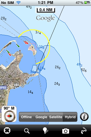
Gorgano Marine Map contains embedded Electronic Nautical charts compressed to a large coverage. Now you can download the Map and transform your mobile device or devices in a Chart Plotter with best Marine Cartography which includes Depth Contours, Soundings, Fishing areas, Anchorage Areas, Buoys, Beacons, Lights, Obstructions, Restricted Areas, Marinas, Ports etc, with requisite values.
· Unique Map interface
· GPS
· Magnetic Compass Integration
· Satellite photo overlay
· Save & email tracks
· Insert Waypoint & check speed, direction & distance
· Insert countless favorites
· Search favorites with Lat/Lon
What's New in This Release:
· Minor bug fixed
· Retina display management
Like it? Share with your friends!
If you got an error while installing Themes, Software or Games, please, read FAQ.
Supported operating systems:
Apple iOS 10.x (iPad), Apple iOS 10.x (iPhone), Apple iOS 11.x (iPad), Apple iOS 12.x (iPad), Apple iOS 12.x (iPhone), Apple iOS 4.0.x (iPhone), Apple iOS 4.0.x (iPod Touch), Apple iOS 4.2.x (iPad), Apple iOS 4.2.x (iPhone), Apple iOS 4.2.x (iPod Touch), Apple iOS 4.3.x (iPad), Apple iOS 4.3.x (iPhone), Apple iOS 4.3.x (iPod Touch), Apple iOS 5.0 (iPad), Apple iOS 5.0 (iPhone), Apple iOS 5.0 (iPod Touch), Apple iOS 6.0 (iPad), Apple iOS 6.0 (iPhone), Apple iOS 6.0 (iPod Touch), Apple iOS 7.0 (iPad), Apple iOS 7.0 (iPhone), Apple iOS 7.0 (iPod Touch), Apple iOS 8.x (iPad), Apple iOS 8.x (iPhone), Apple iOS 8.x (iPod Touch), Apple iOS 9.x (iPad), Apple iOS 9.x (iPhone), Apple iOS 9.x (iPod Touch), Apple iPhone OS 3.1.x, Apple iPhone OS 3.1.x (iPod Touch), Apple iPhone OS 3.2.x (iPad)
Other Software by developer «Flytomap»:
Death Valley National Park - GPS Map Navigator Death Valley National Park - GPS Map Navigator continues in the tradition of offering depth of information and functionality across expected places all over the world, exploring the map you get maximum details obtaining detailed information of each object on the map
Jamaica - GPS Map Navigator Jamaica - GPS Map Navigator - FlytoMap provides complete, quick and easy to use map applications for navigation for iPhone. Continues in the tradition of offering depth of information and functionality across expected places all over the world, exploring the map you get maximum details obtaining detailed information of every object on the map
Ashton Court Estate - (Bristol) - GPS Map Navigator Ashton Court Estate - (Bristol) - GPS Map Navigator - Ashton Court Estate is a wonderful Historical location a must visit place situated in Bristol. It is surrounded by 840 acres having a mixture of woodland and open countryside. There are steep grassy slopes, plantations of native and patterned trees and a deer park
Lake Francis Case - Fishing Lake Francis Case - Fishing - Continues in the tradition of offering depth of information and functionality across expected places all over the world, exploring the map you get maximum details obtaining detailed information of each object on the map
real Tide real Tide is able to calculate TIDE at YOUR GPS position! Flytomap's unique copyrighted algorithm is able to do it nicely!
Tidal flows are important for navigation, and significant errors in position occur if they are not accommodated.
The Tides, Currents, and Water Levels Map provides predicted times and heights of high and low waters
Angelina National Forest - Standard Angelina National Forest - Standard - Continues in the tradition of offering depth of information and functionality across expected places all over the world, exploring the map you get maximum details obtaining detailed information of each object on the map
Mount Ranier National Park - GPS Map Navigator Mount Ranier National Park - GPS Map Navigator - Continues in the tradition of offering depth of information and functionality across expected places all over the world, exploring the map you get maximum details obtaining detailed information of each object on the map
US Rivers - GPS Map Navigator US Rivers - GPS Map Navigator - Continues in the tradition of offering depth of information and functionality across expected places all over the world, exploring the map you get maximum details obtaining detailed information of each object on the map
Cuyahoga Valley National Park - Standard Cuyahoga Valley National Park - Standard - Continues in the tradition of offering depth of information and functionality across expected places all over the world, exploring the map you get maximum details obtaining detailed information of each object on the map
Big Bend National Park - GPS Map Navigator Big Bend National Park - GPS Map Navigator - Continues in the tradition of offering depth of information and functionality across expected places all over the world, exploring the map you get maximum details obtaining detailed information of each object on the map


 - GPS Map Navigator")


