NAVIGON USA for Android - NAVIGON turns your mobile device into a fully featured GPS navigation system. The software provides advanced functionality for both drivers and pedestrians, including 2D and 3D maps, route planner, speed assistant, voice directions, local search, and more.
NAVIGON uses offline maps, so you don't need to worry about data traffic or roaming charges. After installation, you will need to download map data once and then you will be able to use the app without an internet connection. NAVIGON USA for Android features:
· Google Street View destination preview
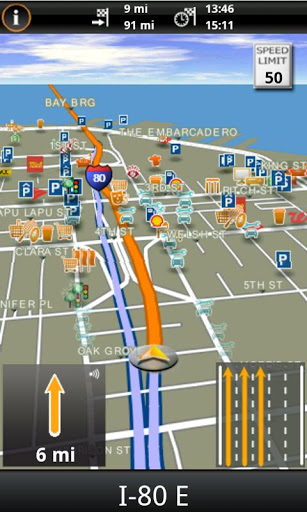
· Lane assistant
· Bluetooth support
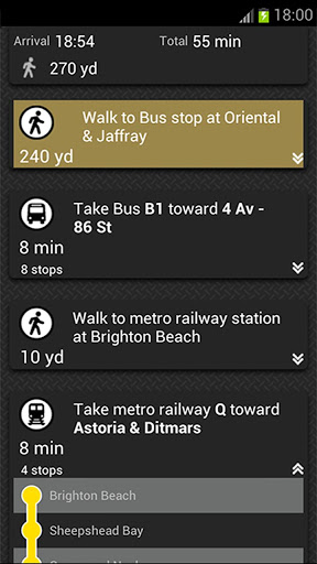
· Google Local Search
· Safety Cameras
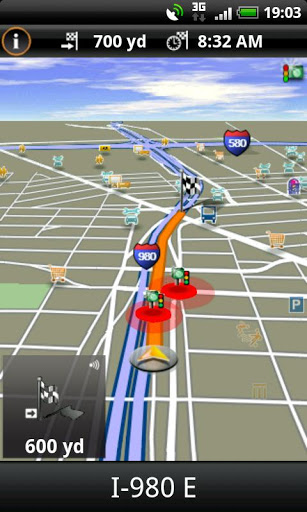
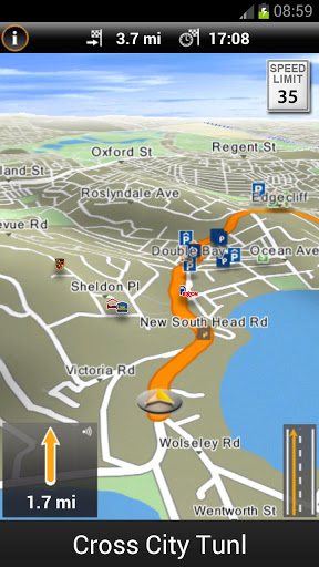
· Reality View Pro
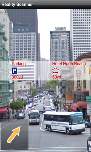
· NAVIGON Reality Scanner
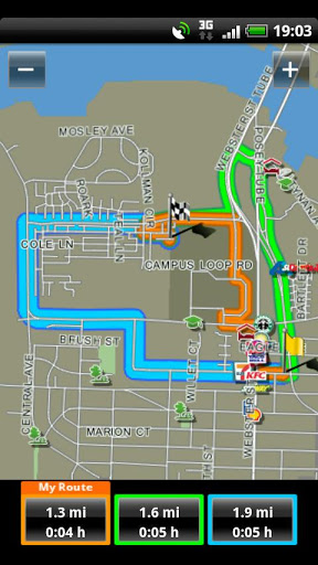
· NAVIGON MyRoutes
· Text-to-Speech and precise spoken announcements
· Destination entry with coordinates
· NAVTEQ map data for USA
What's New in This Release:
· Important bug fix
What's New in 4.9.0:
· Traffic events on route can be read by a TTS voice
· Bug fix
What's New in 4.8.0:
· New graphic support for Full HD devices (Galaxy S4, HTC one etc.)
· General graphic improvements for all devices (sharper images, zoom level)
· List of Glympse recipient shows now who watched the Glympse
· EnergySaver enhanced for general map drawing
· Bug fix (Zoom, map drawing after phone call)
What's New in 4.7.1:
· An additional EnergySaver setting - "Reduced frame rate when no instruction is available" - has been added. This function is the new default for EnergySaver
· Bug fix: Default setting for "Use GPS when app is in background" is set to "off" again
· Bug fix: GPS turned on automatically after app was closed
What's New in 4.6.2:
· Bug fixes
Like it? Share with your friends!
Supported operating systems:
Google Android 10.x, Google Android 2.2, Google Android 2.3, Google Android 3.0, Google Android 3.1, Google Android 3.2, Google Android 4.0, Google Android 4.1, Google Android 4.2, Google Android 4.3, Google Android 4.4, Google Android 5.x, Google Android 6.x, Google Android 7.x, Google Android 8.x, Google Android 9.x
Similar Software:
OSMTracker for Android OSMTracker stands for OpenStreetMap Tracker. It allows you to track your journey and mark significant way points. Way points can be marked with a tag using a button, with a quick voice record, a text note or by taking a picture. The various button pages and layouts can be customized to suit your OpenStreetMap activities
MySpeed MySpeed will record your speed and location to a log file and show it on a map.
It can use a database of speed camera locations to alert you when you're near a speed camera.
There is no speed camera database included. You'll need to download the data from a site such as scdb.info, flitspaal.nl, pocketgpsworld.com, maparadar.com, etc
MapMyRIDE GPS Cycling Riding MapMyRIDE GPS Cycling Riding - tracks the route, distance, pace, and more in real-time using GPS.
NEW: iMapMyRIDE+ for Android
iMapMyRIDE+ brings you its mobile app for Android-based devices! Now owners of Android 2
NAVIGON select NAVIGON MobileNavigator - GPS Navigation NAVIGON MobileNavigator GPS Navigation Very important: ONLY customers who already have one of the previous full versions bought can use this software as an update
Automatic Location Track Track friends or gadgets everywhere to anticipate the alertness and spy on the nearest person
Mobile Spy Track EVERY move your child or employee makes using our POWERFUL cell phone monitoring technology to expose the TRUTH!Mobile Spy is a hybrid software/service which allows you to monitor our child or employee's smartphone in real time
wheredroid wheredroid is a simple application to display your coordinates from the GPS receiver: latitude, longitude, heading, speed, number of satellites used and (it's its peculiarity) altitude and accuracy. It is quite usable as an altimeter and a compass.
What's New in This Release:
· fixes a bug inverting East with West on some displays
What's New in 1.4
AntipodalPoint AntipodalPoint retrieves you position from the network provider or GPS and calculates and shows you antipodal point - the place exact opposite of you on Earth.
AntipodalPoint Pro enables you to browse the entire world and find antipodal points
yozi yozi is a navigation software for the Android platform. It uses digital topographic maps in well-known Ozi Explorer formats for navigation and doesn't require network access like built-in Maps application on Android
amAze (Samsung) AmAze is a first of its kind free navigation and local search service. It is free to download and use and it contains wide coverage of maps including aerial photo in Europe, North America, Australia and parts of Asia and Africa
Other Software by developer «NAVIGON»:
NAVIGON Europe for Android NAVIGON Europe for Android - NAVIGON turns your mobile device into a fully featured GPS navigation system. The software provides advanced functionality for both drivers and pedestrians, including 2D and 3D maps, route planner, speed assistant, voice directions, local search, and more
NAVIGON U.S. Central for iPhone/iPad 2. With NAVIGON MyRegion you can transform your iPhone into a fully functional mobile navigation system that is every bit as good as the multi-award-winning personal navigation devices from NAVIGON in terms of its user-friendliness and features
NAVIGON USA & Canada for Android NAVIGON USA & Canada for Android - NAVIGON turns your mobile device into a fully featured GPS navigation system. The software provides advanced functionality for both drivers and pedestrians, including 2D and 3D maps, route planner, speed assistant, voice directions, local search, and more
NAVIGON Australia for Android NAVIGON Australia for Android - NAVIGON turns your mobile device into a fully featured GPS navigation system. The software provides advanced functionality for both drivers and pedestrians, including 2D and 3D maps, route planner, speed assistant, voice directions, local search, and more
NAVIGON Eastern Europe for Android NAVIGON Eastern Europe for Android - NAVIGON turns your mobile device into a fully featured GPS navigation system. The software provides advanced functionality for both drivers and pedestrians, including 2D and 3D maps, route planner, speed assistant, voice directions, local search, and more
NAVIGON U.S. East for iPhone/iPad 2. With NAVIGON MyRegion you can transform your iPhone into a fully functional mobile navigation system that is every bit as good as the multi-award-winning personal navigation devices from NAVIGON in terms of its user-friendliness and features
NAVIGON U.S. West for iPhone/iPad 2. With NAVIGON MyRegion you can transform your iPhone into a fully functional mobile navigation system that is every bit as good as the multi-award-winning personal navigation devices from NAVIGON in terms of its user-friendliness and features
NAVIGON U.S. West for iPhone/iPad 2.7. NAVIGON U.S. West for iPhone/iPad 2.7. - NAVIGON U.S. West turns your iPhone or iPad into a fully featured GPS navigation system. The software provides advanced functionality for both drivers and pedestrians, including 2D and 3D maps, route planner, speed alerter, lane assistant, voice directions, local search, weather conditions and many others.
NAVIGON U.S

")


")


