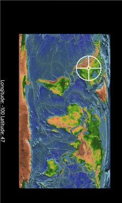
Coordinate Checker - Check the latitude and longitude for a location on the world using this app. Just indicate a location in the world using your finger and the coordinates will be showed.
Like it? Share with your friends!
If you got an error while installing Themes, Software or Games, please, read FAQ.
Supported operating systems:
Windows 10 Mobile, Windows Phone 7, Windows Phone 8
Similar Software:
Compass Free Compass Free application has a GPS compass, Bing maps and waypoints. Helps guide you to home to a car, to a trail head or base camp. Use outside for best results.
Features include:
• GPS Compass
• GPS Accuracy warnings
• Bing Maps
• Waypoints
Please Note:
Compass Free uses GPS triangulation to calculate north
GPS Distance GPS Distance - GPS Distance vous permet de calculer rapidement et facilement la distance i vol d'aoiseau qu'il y a entre deux coordonnees GPS.
Les coordonnees sont donnees de facon decimales representant la valeur de l'angle en degre et le resultat est donnee en kilometre
Simple Altimeter Free Simple Altimeter Free - This app answers one simple question: What's my elevation, according to the phone's GPS chip?
Have you ever been hiking, skiing, boarding, or even just driving and wondered what your approximate elevation is? This is the app for you. The best part is that it's free!
Disclaimer: This app is only as accurate as the GPS chip in your phone
Speedo Speedo - Digital GPS Speedometer.
See your speed. This app shows GPS based accurate SPEED, heading, altitude and Latitude & Logitude in real time. It records your Top Speed and you can see it in a map where you were doing max speed. You would be able to email this location information to your friend. Shows speed in KMPH, MPH or m/s
Jack of Tools Jack of Tools makes your phone into a virtual tool belt. Want to know exactly where you are? Ever wonder how fast that roller coaster ride really is? How high are you? Or maybe you just want to get that desk level
Weekend Overdrive Weekend Overdrive shows many useful indicators for passengers on car drive.
Indicators such as compass, clinometer, reverse geo coder, altitude, temperature, twitter helps you recognize your situation
Landmeter Landmeter - Call it inclinometer, call it clinometer, call it levels, call it whatever you like ... but you don't have enough of them ... There is still one missing ...
LandMeter is the official inclinometer for all off-roads enthusiasts, 4x4 cars, trucks, jeep, landrover, and trailers
Other Software by developer «d.i.m. IT»:
UiTagenda The most complete cultural and leisure agenda for Flanders and Brussels!