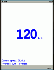
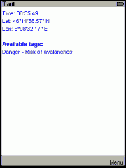
GeoVTag is a J2ME application running on a mobile phone that allows the user to publish anywhere on Earth virtual tags. Every user in the neighborhood of such a publication point will get the message. For example, let us consider the community of the Mt-Blanc mountain guides. The members would like to inform their colleagues about dangers in specific places or about vacancies in refuges. One guide can publish such a geo-referenced message that informs about a high risk of avalanches, and any other guide that attends the same place will get the warning. It is a kind of blog, in which editors and readers share the same physical place.
Like it? Share with your friends!
Requirements:J2ME phones
Supported operating systems:
Java ME, Java Nokia 240x320, Java SE 240x320
Similar Software:
FON Access Points for Jordan FON Access Points for Jordan - FON offers you a new Points of Interest service (POIs). This allows you to download FONspots directly to your navigation device.
What does that mean? You can download a Points of Interest file directly to your navigation device
FON Access Points for Greece FON Access Points for Greece - FON offers you a new Points of Interest service (POIs). This allows you to download FONspots directly to your navigation device.
What does that mean? You can download a Points of Interest file directly to your navigation device
GpsMid Canada, Ontario GpsMid Canada, Ontario is a free, fully offline, vector based map application for your mobile phone. It displays your current position on a zoomable map and can be used to search for and navigate to roads or points of interest of your liking. As all data is stored in a compact binary format on your mobile phone you will incur no charges for extra data downloads
GpsMid Midlands and Northern England GpsMid Midlands and Northern England is a free, fully offline, vector based map application for your mobile phone. It displays your current position on a zoomable map and can be used to search for and navigate to roads or points of interest of your liking
GpsMid Saudi Arabia GpsMid is a free, fully offline, vector based map application for your mobile phone. It displays your current position on a zoomable map and can be used to search for and navigate to roads or points of interest of your liking. As all data is stored in a compact binary format on your mobile phone you will incur no charges for extra data downloads
OpenDMTP OpenDMTP - OpenDMTP (Open Device Monitoring and Tracking Protocol) is a highly configurable and extensible protocol for communicating with mobile devices over high-latency/low-bandwidth networks. The protocol is particularly geared towards the transmission of GPS base location information and includes a full-featured reference implementation showcasing its capabilities
Place Finder A tool for finding places of interest in the vicinity of a location keyword. Wikipedia location keywords are used to locate quickly and easily avoiding high data charges for other on-line location services. Three versions available - UK,West/East USA
OpenWIG OpenWIG is an attempt to develop a J2ME mobile application (midlet) with the same capabilities as Wherigo player. It achieves this by implementing Lua extensions used in Wherigo source files.
A list cartridges successfully tested with the openWIG player can be found here
FoxyTag FoxyTag - FoxyTag is a free, legal and collaborative system to signal speed cameras on mobile phones. The idea consists in posting virtual tags close to speed cameras in order to warn the other drivers. These users will then get an alarm when they are closer than 15 seconds to a critical point, and a red point locating the speed camera appears on their screen