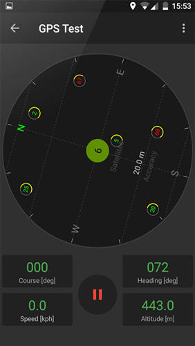
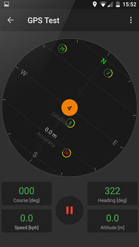
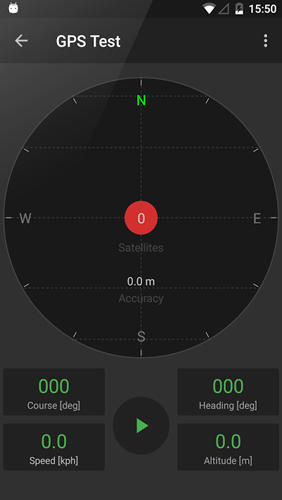
GPS Tools - is an application for calibration of a satellite module of your smartphone. The utility uses a magnetic compass, makes changes to the route, speed and accuracy of the displayed data. As soon as the calibration is completed you can track your location with maximum accuracy.
Game features:
Magnetic compass
Commercial free
Fast calibration
Big number of satellites
Like it? Share with your friends!
Supported operating systems:
Google Android 10.x, Google Android 4.4, Google Android 5.x, Google Android 6.x, Google Android 7.x, Google Android 8.x, Google Android 9.x
Similar Software:
Satski Lite Satski Lite - The #1 ski/snowboard app. Real time ski navigation on 3D trail/piste maps. Imagine seeing your live GPS position, tracking & stats (speed, dist, alt). Use buddy tracking, get resort info, live weather, SOS
Geofence Tracker Why do you need Geofence Tracker application?
1. With Geofence Tracker, you can create a specific "safe zone" or "unauthorized zone" on a map and get an E-mail Alert if the phone leaves the area
NearMe NearMe application gives you a fast and easy way to find places near you. In addition, you can set the area (in Km) where to search. With every found place you have some useful options:
* Call
* Add To Contacts
* Open In Maps
* Get Directions
And other option is History: it keeps for you all places you have searched for
LocationBot Lite LocationBot is an Android app that can change various settings on your phone according to your location. For example, it can switch the phone's WiFi and Bluetooth on when you are in your home or at your favourite coffee shop, or turn the volume down and set vibrate on when you are at work/church/cinema
OpenSatNav OpenSatNav brings open-source satellite navigation to Android handsets.
· All code is open source.
· Global maps and navigation based on OpenStreetMap data
· Navigation by car, bicycle or by foot
amAze (Motorola) AmAze is a first of its kind free navigation and local search service. It is free to download and use and it contains wide coverage of maps including aerial photo in Europe, North America, Australia and parts of Asia and Africa
Android Photo GeoTag Android Photo GeoTag - Take pictures with your mobile phone and incorporate the data of the geographical location. The application allows you to include in the photographs, data from the GPS receiver, along with a brief note. If you know the coordinates, not having the GPS receiver, you can also handwrite geographic data
AnaFain (Android) AnaFain (Android) is a Family GPS Tracker that allows parents to track loved ones using their mobile phones. AnaFain consists of a web portal (anafain.com) that allows parents to see the location of their kids in real-time on a map and a small mobile application running on the kids' mobile phones. Parents can define safety zones (school, mall, etc
Maps In My Pocket (MIMP) Maps In My Pocket - The main goal of this application is to allow its users to view maps, locate themselves, follow KML or GPX formatted tracks and getting directions from place to place.
What's New in This Release:
· New Icon
What's New in 1.4.3:
· Long press and long pinch concurrency on info bubble solved
GPS Tracker GPS tracker for Android supporting KML export (Google Earth) and raw format export as txt data
Comments on GPS Tools:
Comments not found
If you noted an error or download link is broken, please, report it via this page or use comments.
GPS Tools is compatible with your device Huawei Honor 7 Standard Edition Dual SIM TD-LTE PLK-UL00


")

")
")
