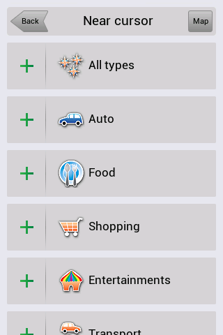
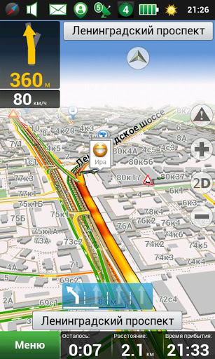
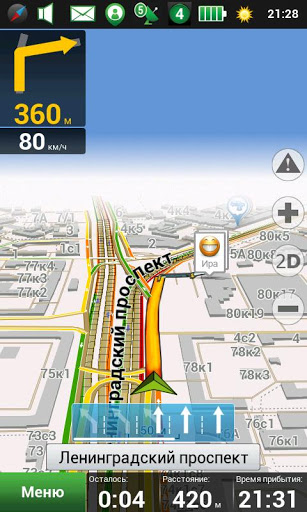
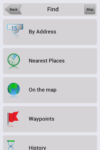
Navitel Navigator for Android - Navitel Navigator is a GPS travel assistant for Android. The app turns your phone into a personal navigation system.
Navitel Navigator comes with detailed maps and other useful features, including traffic jams, speedcams, 3D roads and intersections, instant routing and a comprehensive database with points of interest.
· 30 days trial
What's New in This Release:
· map subscription available;
· vibration of the navigation device in response to use of the keyboard;
· bugs occurring at POI search along the route are fixed;
· traffic jams are rendered quicker in maps.
What's New in 8.0.0.267:
· To Menu - Settings - Navitel.Friends added new option - "Hide irrelevant".
· While installing the minimum values of map detail, buildings are displayed as single-storey.
· Display of textures through the translucent building was fixed.
· Rendering of colors and lighting of 3D models was improved.
· Display of the houses' numbers in 3D mode was fixed.
· Incorrect work of the program on devices Prestigio GeoVision 5500 was fixed.
What's New in 8.0.0.192:
· Option of map scale selection for 3D buildings display was added to the settings.
· As you zoom in more than 3 km, function "Track Up", when following a route, changes to the orientation "North".
· To Menu - My Navitel was added information about version number and size of available update.
· Errors, when drawing some polylines in 3D, were fixed.
· Accuracy of the voice guidance on roundabouts was improved.
· Android 1.5 is no longer supported.
What's New in 8.0.0.0:
· Hardware-accelerated rendering is implemented (OpenGL)
· New 3D maps with number of storeys support and textures
· New 3D models of attractions
· Brand POI
· Traffic jams sensitivity setting
· More detailed description of friends' location on the map is implemented.
· Zoom buttons bugs in "My Route" window were fixed.
· Also other numerous minor fixes, enhancing the stability and reliability of the program, were made
What's New in 7.5.0.2131:
· Automatic SPEEDCAM update from the program menu.
· Personal settings, history, waypoints storing after update installation.
· Dashboard selection on the map while driving on the route.
· Profile switching without having to restart the application.
· Automatic renaming of exported files (routes, waypoints) in order to avoid existing data rewriting.
· Objects naming display is improved during map scrolling.
What's New in 7.5.0.1342:
· Кeyboard for Armenian, Georgian and Azerbaijani languages was added.
· Information of the program's and maps' version was included in menu My Navitel.
· Display of owner's devices on the map attached to the service Navitel.Friends was realized.
· Search by the POI on the route was improved.
What's New in 7.0.0.176:
· View mode and edit mode of "Navitel.Friends" privacy settings are implemented.
· New icons of road infrastructure and weather on the map are added.
· License agreement (Public offer) is updated .
· Multi-touch operation in search result is fixed.
· Bug that caused program hang, during intersections search, was fixed.
· Program zoom is improved on very small and very large scales.
Like it? Share with your friends!
Supported operating systems:
Google Android 1.5, Google Android 1.6, Google Android 10.x, Google Android 2.0, Google Android 2.1, Google Android 2.2, Google Android 2.3, Google Android 3.0, Google Android 3.1, Google Android 3.2, Google Android 4.0, Google Android 4.1, Google Android 4.2, Google Android 4.3, Google Android 4.4, Google Android 5.x, Google Android 6.x, Google Android 7.x, Google Android 8.x, Google Android 9.x
Similar Software:
CoPilot Live Europe (Android) CoPilot Live Europe (Android) - CoPilot Live is full-featured voice-guided GPS navigation with Western and Eastern Europe street maps stored on your phone. Includes 3D guidance, lane assist, speed limit warnings, safety camera alerts, planning mode.
Download maps via WiFi after purchase. Unlimited use after 10 days once Google order verified
AndTripLog AndTripLog allows you to record your trip onto your device. The application displays the current GPS position, time and speed. You can export the trip by email and store it onto your sdcard in GPX format
GPS Coordinates Converter GPS Coordinates Converter - With this app you can convert GPS coordinates from "degrees, minutes, decimal seconds" to "decimal degrees".
What's New in This Release:
· Locate your phone and show the coordinates
What's New in 2
Modern Compass Modern Compass this compass does what the compass always was intended to do, it helps you locate the destination of your choice.
Using GPS technology and Google maps, this application lets you mark a destination of choice and then shows in what direction that destination lies, as well as how far away it is from your current location
wheredroid wheredroid is a simple application to display your coordinates from the GPS receiver: latitude, longitude, heading, speed, number of satellites used and (it's its peculiarity) altitude and accuracy. It is quite usable as an altimeter and a compass.
What's New in This Release:
· fixes a bug inverting East with West on some displays
What's New in 1.4
Mobile Tracker - Offline Mobile Tracker - Offline - mobile tracker offline is a personal application through which you can track UNLIMITED mobile tracking offline. All your track data is available on your device only. So, Don’t need to worry about your personal data lose. It is very simple and useful app that helps you to track your own location date wise
EV Speedo EV Speedo is a GPS based speedometer with gadgets to provide g-force and other GPS information.
A built in map is also provided and any of the gauges provided can be overlayed upon the map, for example use the map to show your location with a speedometer to show your current speed
TomTom Canada & Alaska for Android TomTom Canada & Alaska for Android - TomTom Canada & Alaska is a turn-by-turn GPS navigator for Android devices. The app includes accurate offline maps, so you can find your way anywhere, even without an internet connection
GPS Share GPS Share Have you ever been trying to meet friends in a large public space, but been unable to find each other? GPS Share was created for just such a scenario.
Use GPS Share to share your location how you want, whether it’s SMS, Email, Twitter, or something else. Because GPS Share uses no external services besides Google Maps, your privacy isn’t a concern
ParkLeitSystem ParkLeitSystem is a car-park-routing system. It shows you, according to your GPS position, the nearest city with a car-park-routing system and gives you a list with all available car-parkings and shows how many free places there are. With a click on the parking it switches to google maps and shows you the position of the parking
Other Software by developer «Navitel»:
Navitel Navigator Symbian “Navitel Navigator” is a unique and accurate navigation system. Detailed Russia map. Free traffic jams information service. SPEEDCAMs. The most detailed map of Russia: more than 118 000 cities and towns, 1500 of them contain address search information. The most detailed Moscow and Saint-Petersburg map
Navitel Navigator for Symbian Navitel Navigator for Symbian - Navitel Navigator is a GPS travel assistant for Symbian. The app turns your phone into a personal navigation system.
Navitel Navigator comes with detailed maps and other useful features, including traffic jams, speedcams, 3D roads and intersections, instant routing and a comprehensive database with points of interest
Navitel Navigator (Belarus) for iPhone/iPad Navitel Navigator (Belarus) for iPhone/iPad - Navitel Navigator is a GPS travel assistant for iPhone, iPad and iPod touch. The app turns your phone into a personal navigation system
Navitel Navigator for iPhone/iPad Navitel Navigator for iPhone/iPad - Navitel Navigator is a GPS travel assistant for iPhone, iPad and iPod touch. The app turns your mobile device into a personal navigation system
Navitel Navigator (Commonwealth) for iPhone/iPad Navitel Navigator (Commonwealth) for iPhone/iPad - Navitel Navigator is a GPS travel assistant for iPhone, iPad and iPod touch. The app turns your phone into a personal navigation system
Navitel Navigator for Windows Mobile Navitel Navigator for Windows Mobile - Navitel Navigator is a GPS travel assistant for Windows Mobile. The app turns your phone into a personal navigation system.
Navitel Navigator comes with detailed maps and other useful features, including traffic jams, speedcams, 3D roads and intersections, instant routing and a comprehensive database with points of interest
Navitel Navigator Android “Navitel Navigator” is a unique and accurate navigation system. Detailed Russia map. Free traffic jams information service. SPEEDCAMs. The most detailed map of Russia: more than 118 000 cities and towns, 1500 of them contain address search information. The most detailed Moscow and Saint-Petersburg map
Navitel Navigator (Russia) for iPhone/iPad Navitel Navigator (Russia) for iPhone/iPad - Navitel Navigator is a GPS travel assistant for iPhone, iPad and iPod touch. The app turns your phone into a personal navigation system
Navitel Navigator (Turkey) for iPhone/iPad Navitel Navigator (Turkey) for iPhone/iPad - Navitel Navigator is a GPS travel assistant for iPhone, iPad and iPod touch. The app turns your phone into a personal navigation system


")


 for iPhone/iPad")

 for iPhone/iPad")


 for iPhone/iPad")
 for iPhone/iPad")