Realtrack Mobile 1.5 PocketPC
RealTrack Mobile is a mobility solution (Fleet Management and mobile devices tracking Comprehensive System, via GPS through GPRS or WIFI, and through INTERNET access) made up of a set of applications, which allow the user to remotely track any person or object carrying a mobile device of the PDA PocketPC type, and the most important aspect is that this information is given in real time.
The system consists of a server software or Control Centre ?RealTrack Mobile Server?, and the application for mobile devices ?Realtrack Mobile PocketPC?, which are client applications of the Control Centre.
RealTrack Mobile offers, moreover, an innovative utility, the compatibility with Google Earth; with that, apart from viewing the location in one of the best, real cartographies in the market, it has another advantage: several users may display the location of the mobile device at the same time, all that the user needs is an Internet connection.
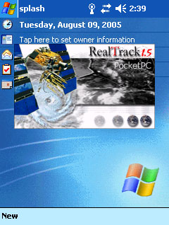
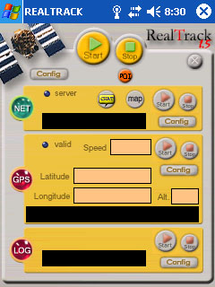
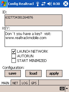
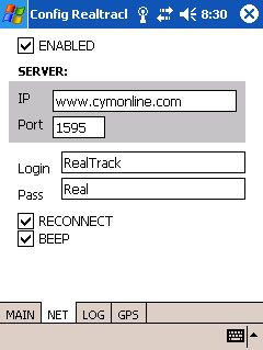
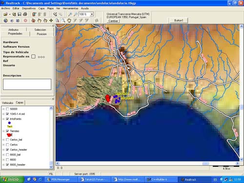
Screenshots:
General Features:
? Location and tracking in real time via GPS of the mobile devices of the fleet.
? Compatibility with PDA PocketPC.
? Licence for 1 PocketPC mobile device.
? Data transfer in real time from the mobile device to the server.
? Show in cartography and Display in any software admitting GPS connection or through the COM port of the GPS locations.
? History creation and process at the control centre of the routes followed by mobile devices, so that the evolution of services in a given period can be subsequently studied.
? Display of the mobile device speed.
? Calculation of the distance covered by the mobile device.
? Definition of waypoints in route.
? CHAT: communication between the mobile device and the server via CHAT, this is carried out via a GPRS connection to the RealTrack server in the PC, thus enabling the message transfer at a minimum cost as compared with traditional SMS.
? Storing of GPS locations in a file (Data Logger).
? Persistent Bluetooth connection.
? Log transfer to the PC for their subsequent process, GPRS connection not needed.
? Display of the location, latitude and longitude in the mobile.
? Possibility to establish a name for the information points in real time and to communicate it to the server for its storing in its database.
? Link with dynamic GPS once it has been connected. If the mobile moves away and the connection with the GPS is cut, it will be automatically restored as soon as the mobile is within an appropriate distance radius again.
Summary of Realtrack Server features:
It opens and displays the following formats:
- Raster: TIFF/GeoTIFF, ECW, MrSID, JPEG2000, JPEG, IMG, BMP, BIL/SPOT, PNG, CADRG
- Vector: SHP, E00, MIF/MID, TAB, DXF, DGN, TIGER, GML, VPF, GDF, DLG, SDTS
- DTM format: ASCII GRID, FLOAT GRID, BT, DTED, and ADF
- Georeferenced images: GeoTIFF, World File, and TAB
Change of projection and Datum.
Zoom +/-, pan.
Scale defined by the user for the display and printing.
Project creation.
It handles in a fast and efficient way SHP files (up to 2 gigabytes!).
Control to add, remove, and reorganize the layers of the project.
Control to modify the appearance (Colours, styles, outlines, symbols, transparencies, etc.) of vector layers.
Control to add, erase, and modify points, lines and areas of a layer.
It shows Bar and Pie charts.
Inquiries by attributes.
Multi-field labelling.
Etc.
Screenshots:
|
