VGPS was designed to use city street map on your ordinary mobile phone without the need of having GPS receiver or internet connection. VGPS does not require internal or external GPS receiver. However, if you have internal GPS receiver or external bluetooth GPS receiver, VGPS can work with your GPS receiver as well. VGPS does not require internet connection so you no need to worry about connection charge.
· Offline map (totally offline application. VGPS only uses internet to validate your purchase when you activate demo version become full version. Other than that the application will never use internet)
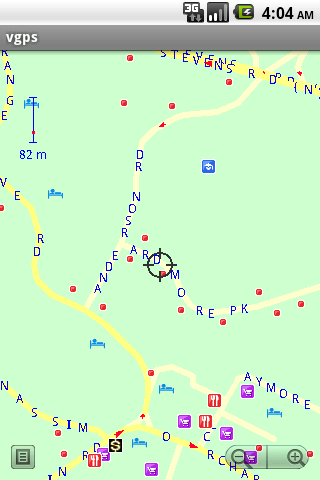
· Map data from Garmin and OpenStreetMap
· Zoom in/Zoom out/Pan
· Search point by name,type,distance or mix type+name, type+distance
· Can touch any object on the map
· GPS real-time tracking
· Routing point to point
· Rotate map so the driving direction (heading) is always up
· Voice guidance (turn left/turn right)
Like it? Share with your friends!
Supported operating systems:
Google Android 1.5, Google Android 1.6, Google Android 10.x, Google Android 2.0, Google Android 2.1, Google Android 2.2, Google Android 2.3, Google Android 3.0, Google Android 3.1, Google Android 3.2, Google Android 4.0, Google Android 4.1, Google Android 4.2, Google Android 4.3, Google Android 4.4, Google Android 5.x, Google Android 6.x, Google Android 7.x, Google Android 8.x, Google Android 9.x
Similar Software:
Satsports Log Satsports Log is your general sport app. Ideal for running, cycling, mountain biking, hiking and walking. It also has some fun visual features such as maps and graphs of your elevation, speed and pace. Real time Statistics: Satsports-log has all the stats you could wish
Zeen - Building Road Awareness Zeen, building road awareness together! Zeen is a fully featured, community driven mapping solution. - Over 500,000 data points at launch! Will continue to build thanks to the community! - Police Locations - Red Light Camera Locations - Speed Camera Locations - Traffic Reports / Locations
Waze: Community GPS navigation Waze: Community GPS navigation - Waze is a free, 100% user-generated, social navigation app that allows drivers to build and use live maps & real-time traffic updates to improve their daily commute
Geopaparazzi Geopaparazzi is a tool developed to do fast qualitative technical and scientific surveys. Its strength is its direct connection to the BeeGIS GIS, that can be used to further process the collected data.
Even if the main aim is in the field of surveying, it contains tools that can be of great use also to tourists that want to keep a geo-diary
AntipodalPoint AntipodalPoint retrieves you position from the network provider or GPS and calculates and shows you antipodal point - the place exact opposite of you on Earth.
AntipodalPoint Pro enables you to browse the entire world and find antipodal points
MileageLedger (Android) MileageLedger is a GPS powered mileage logging application designed for Android enabled phones. The paid version of MileageLedger generates log files that meet requirements of IRS Publication 463, Section 5 which states:
"You should keep adequate records to prove your expenses or have sufficient evidence that will support your own statement
TomTom Europe for Android TomTom Europe for Android - TomTom Europe is a turn-by-turn GPS navigator for Android devices. The app includes accurate offline maps, so you can find your way anywhere, even without an internet connection
GPS Tracker GPS tracker for Android supporting KML export (Google Earth) and raw format export as txt data
TapIn Places TapIn Places is all about your daily check-in places by tap.
· View nearby places around your location.
· Shared Facebook wall posting.
· Search your favorite places with or without categories simply.
· Manage recent and favorite places.
· Bookmarks your favorite places simply.
· Long click item list to view action detail
Local Local - Local is your best application to find any place you are looking for near you. Local offers you so easy and customized search with best filtered results, show you places as per user ratings. You can see complete details of a local place like opening and closing timings, map, Google+ profile, users reviews, price range
Other Software by developer «Vietnamese GPS»:
VGPS (Vietnamese GPS) VGPS (Vietnamese GPS) - was designed to use city street map on your ordinary mobile phone without the need of having GPS receiver or internet connection. VGPS does not require internal or external GPS receiver. However, if you have internal GPS receiver or external bluetooth GPS receiver, VGPS can work with your GPS receiver as well
VGPS (Vietnamese GPS) for Android VGPS (Vietnamese GPS) for Android was designed to use city street map on your ordinary mobile phone without the need of having GPS receiver or internet connection. VGPS does not require internal or external GPS receiver. However, if you have internal GPS receiver or external bluetooth GPS receiver, VGPS can work with your GPS receiver as well

")
 for Android")
 for Android")


")


")
 for Android")