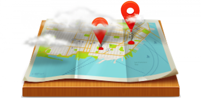
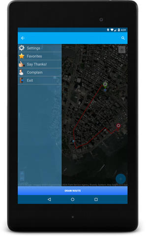
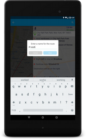
Best Route GPS Navigator - Are you planning walk, go to the store or to work? "Best Route" will show the best way for you to save your nerves and time. Because time is money!
Like it? Share with your friends!
Supported operating systems:
Google Android 10.x, Google Android 2.3, Google Android 3.0, Google Android 3.1, Google Android 3.2, Google Android 4.0, Google Android 4.1, Google Android 4.2, Google Android 4.3, Google Android 4.4, Google Android 5.x, Google Android 6.x, Google Android 7.x, Google Android 8.x, Google Android 9.x
Similar Software:
GPS Dashboard GPS Dashboard - View the status of the GPS on your phone with this cool Dashboard
amAze (Motorola) AmAze is a first of its kind free navigation and local search service. It is free to download and use and it contains wide coverage of maps including aerial photo in Europe, North America, Australia and parts of Asia and Africa
FastToolBar FastToolBar - It is simple and easy controller:
-Sound control
-WiFi control
-Bluetooth control
-GPS control
One click and you can turn on/off this functions.
Simple and very convenient widget will not take you on the phone a lot of memory
Polaris Navigation System Polaris Navigation System - The Polaris Navigation System is a powerful navigation software for Android. It includes all the standard GPS functionality, including an odometer, altimeter, speedometer and directional compasses.
The app also allows you to record trails and view them on a map
RMaps RMaps is a navigation tool. You can use RMaps as an online map viewer for some popular maps. And as an offline map viewer for your own maps created on the PC.
· Auto rotate map in driving direction.
· Auto rotate map in the northern direction.
· Compass on the map.
· Auto-follow function.
· Online search.
· Full screen mode
AugSatNav Walk AugSatNav is an augmented reality navigation system which overlays walking directions upon a live video feed of the path or road ahead.
With AugSatNav there is no need to follow instructions or interpret maps - you can simply find your way by walking along the route highlighted by a bright white line
Mobile Spy Track EVERY move your child or employee makes using our POWERFUL cell phone monitoring technology to expose the TRUTH!Mobile Spy is a hybrid software/service which allows you to monitor our child or employee's smartphone in real time
MapMyHike+ for Android MapMyHike+ for Android - MapMyHike is a mobile assistant designed to allow hikers to track their activities using their phone's built-in GPS.
With the app you can view your route on a map and record your trip details, including duration, distance, pace, speed and elevation.
You can also share the details of your activity with friends via Facebook, Twitter or email
Location Barcoder Location Barcoder is a tool for creating geocoded barcodes based on your location. Barcodes are stored on the SDCard in a folder named LocationBarcodes
OSMTracker for Android OSMTracker stands for OpenStreetMap Tracker. It allows you to track your journey and mark significant way points. Way points can be marked with a tag using a button, with a quick voice record, a text note or by taking a picture. The various button pages and layouts can be customized to suit your OpenStreetMap activities
Other Software by developer «Devosoftmir»:
not found
Comments on Best Route GPS Navigator:
Comments not found
If you noted an error or download link is broken, please, report it via this page or use comments.
Best Route GPS Navigator is compatible with your device BBK Vivo Y93st Standard Edition Dual SIM TD-LTE CN V1818CA (BBK V1818C)

")


")


