Outdoor Share for Android - The Outdoor Navigation software is your best friend through your adventures in the wild.
Go into the outdoors with confidence and enjoy your activities without worrying about the tools to help you navigate. Your Outdoor Navigation app is made by the people who have been developing this software since 2003 across multiple platforms. Be sure that you will stay ahead of the rest with continuous updates and relevant tools.
It is an excellent tool for biking, jogging, skiing, hiking, geocaching, boating, flying and many other sporting activities.
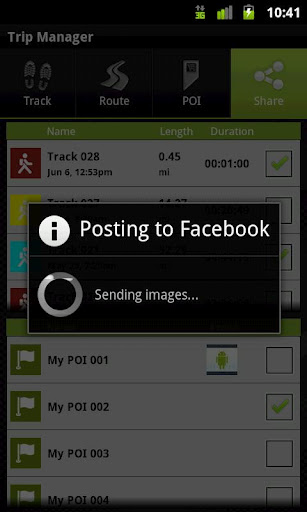
Your Outdoor Share will give you the ability to take those valuable tracks and POIs that you have created with your Outdoor Navigation base application and share them with your Facebook pals by uploading them to your Facebook account.
· Allows to share tracks and POIs with Facebook (besides the sharing via mail that is available also in the base version)
Installation instructions:
Outdoor Share is an add-on for the free Outdoor Navigation application. You need to have your Outdoor Navigation installed to be able to use Outdoor Share.
Download and install Outdoor Share on your Android device. Start the Outdoor Share plugin to complete the license checking: when activation will be completed then the icon will be removed (you need to restart your device to hide the icon) and the plugin will be used inside Outdoor Navigation application.
What's New in This Release:
· Bug fixing
Like it? Share with your friends!
Supported operating systems:
Google Android 10.x, Google Android 2.1, Google Android 2.2, Google Android 2.3, Google Android 3.0, Google Android 3.1, Google Android 3.2, Google Android 4.0, Google Android 4.1, Google Android 4.2, Google Android 4.3, Google Android 4.4, Google Android 5.x, Google Android 6.x, Google Android 7.x, Google Android 8.x, Google Android 9.x
Similar Software:
MapMyRIDE GPS Cycling Riding MapMyRIDE GPS Cycling Riding - tracks the route, distance, pace, and more in real-time using GPS.
NEW: iMapMyRIDE+ for Android
iMapMyRIDE+ brings you its mobile app for Android-based devices! Now owners of Android 2
MarineTraffic.com MarineTraffic.com - Real-time ships positions based on Automatic Identification System (AIS). Watch the positions reported by more than 35000 vessels per day on an interactive Google map.
The application provides worldwide coverage of more than 850 ports and a significant number of open-sea areas.
Port arrivals and departures are recorded in real-time
Radardroid Lite GPS speed camera warning application for Android devices. Radardroid will give a visual and audible warning when you approach any fixed or mobile speed camera in the application database. This application will give you advanced warning of possible danger ahead and will reduce possible speeding tickets thanks to the ever increasing available features
SOS App SOS App - This app sends a text message with your GPS position (address from google maps, latitude, longitude and accuracy).The use is simple. You have to choose a contact (with the search button) and then touch the picture
GPS Speedometer & Flashlight GPS Speedometer & Flashlight - GPS Speedometer & Flashlight is a free app for Android devices with built-in GPS receiver. It functions as a normal speed gauge found in every car, displaying the velocity of the vehicle.
In addition, the software includes an easy to use flashlight
Geocast A location and multimedia enabled file sharing application
Navizon for Android Navizon for Android is an on-demand location system based on push-technology. Once it is installed, Navizon will let you track the mobile device's location with a click of a button. This can be especially useful if you lost your phone or if you are trying to locate a friend
TomTom South East Asia for Android TomTom South East Asia for Android - TomTom South East Asia is a turn-by-turn GPS navigator for Android devices. The app includes accurate offline maps, so you can find your way anywhere, even without an internet connection
CoPilot Live UK + Ireland (Android) CoPilot Live UK + Ireland (Android) - CoPilot Live is full-featured voice-guided GPS navigation with street maps of 1 European region stored on your Android phone. Includes 3D guidance, lane assist, speed limit warnings, safety camera alerts, planning mode.
Download maps via WiFi after purchase. Unlimited use after 10 days once Google order verified
Navitel Navigator for Android Navitel Navigator for Android - Navitel Navigator is a GPS travel assistant for Android. The app turns your phone into a personal navigation system.
Navitel Navigator comes with detailed maps and other useful features, including traffic jams, speedcams, 3D roads and intersections, instant routing and a comprehensive database with points of interest
Other Software by developer «GPS Tuner»:
GPS Tuner Essentials Full Version with Germany, Austria, Switzerland Basic Map Content GPS Tuner Essentials Full Version with Germany, Austria, Switzerland Basic Map Content is designed specifically for off-road use: its large buttons, selectable tool window size, multiple Compass views and the built-in Tele Atlas map makes it extremely user-friendly and reliable
GPS Tuner Atlas Full Version with South America Basic Map Content GPS Tuner Atlas Full Version with South America Basic Map Content is designed specifically for off-road use: its large buttons, selectable tool window size, multiple Compass views and the built-in Tele Atlas map makes it extremely user-friendly and reliable
GPS Tuner Essentials Full Version with Central Europe Basic Map Content GPS Tuner Essentials Full Version with Central Europe Basic Map Content is designed specifically for off-road use: its large buttons, selectable tool window size, multiple Compass views and the built-in Tele Atlas map makes it extremely user-friendly and reliable
GPS Tuner Essentials Full Version with Canada Basic Map Content GPS Tuner Essentials Full Version with Canada Basic Map Content is designed specifically for off-road use: its large buttons, selectable tool window size, multiple Compass views and the built-in Tele Atlas map makes it extremely user-friendly and reliable
GPS Tuner Essentials Full Version with Nordic Countries Basic Map Content GPS Tuner Essentials Full Version with Nordic Countries Basic Map Content is designed specifically for off-road use: its large buttons, selectable tool window size, multiple Compass views and the built-in Tele Atlas map makes it extremely user-friendly and reliable
Outdoor Compass for Android Outdoor Compass for Android - The Outdoor Navigation software is your best friend through your adventures in the wild.
Go into the outdoors with confidence and enjoy your activities without worrying about the tools to help you navigate. Your Outdoor Navigation app is made by the people who have been developing this software since 2003 across multiple platforms
Outdoor Navigation Pro for Android Outdoor Navigation Pro for Android - The Outdoor Navigation software is your best friend through your adventures in the wild.
Go into the outdoors with confidence and enjoy your activities without worrying about the tools to help you navigate. Your Outdoor Navigation app is made by the people who have been developing this software since 2003 across multiple platforms
GPS Tuner Essentials Full Version with BENELUX Basic Map Content GPS Tuner Essentials Full Version with BENELUX Basic Map Content is designed specifically for off-road use: its large buttons, selectable tool window size, multiple Compass views and the built-in Tele Atlas map makes it extremely user-friendly and reliable
Outdoor SOS for Android Outdoor SOS for Android - The Outdoor Navigation software is your best friend through your adventures in the wild.
Go into the outdoors with confidence and enjoy your activities without worrying about the tools to help you navigate. Your Outdoor Navigation app is made by the people who have been developing this software since 2003 across multiple platforms
GPS Tuner Essentials Full Version with France, Monaco, Belgium, Switzerland Basic Map Content GPS Tuner Essentials Full Version with France, Monaco, Belgium, Switzerland Basic Map Content is designed specifically for off-road use: its large buttons, selectable tool window size, multiple Compass views and the built-in Tele Atlas map makes it extremely user-friendly and reliable

")


")


