Categories: Business & Profession, Travel & Navigation
Upload date: 3 Nov 11
Developer: Code Sector
License: Freeware
Downloads: 2894 File Size: 2551 Kb
SpeedView - An advanced speedometer application that offers lots of useful features.
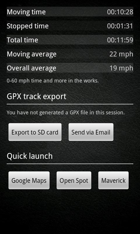
SpeedView uses the phone's built-in GPS system to show your current, maximum and average speed, as well as direction, total distance and time traveled. Suitable for running, car driving, biking or hiking.
* High accuracy
GPS-based speedometer that is more accurate than the one in your car.
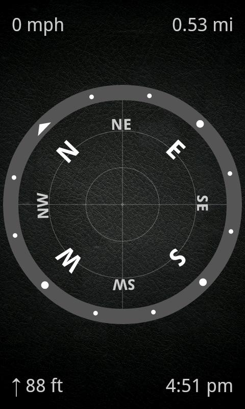
* Linear compass
Shows your direction of travel. Compass mode is also available.
* HUD mode
Mirrors the numbers so you can place the phone under your car's windshield and see the speed reflected on it in the dark.
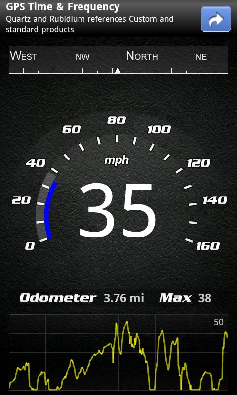
* Speed graph
Displays a graph chart covering the last several minutes.
* Speed warning
You can set speed limits for three different types of roads, so when you go over a visual alert or sound will notify you.
* Display units
Supports units such as miles, kilometers and nautical miles.
* GPX track export
Enables you to save your current track to SD card or email it to someone. GPX format is supported by many applications.
* Background mode
You can minimize the program and keep it running in background. It will work as usual and even notify you when you exceed the speed limit!
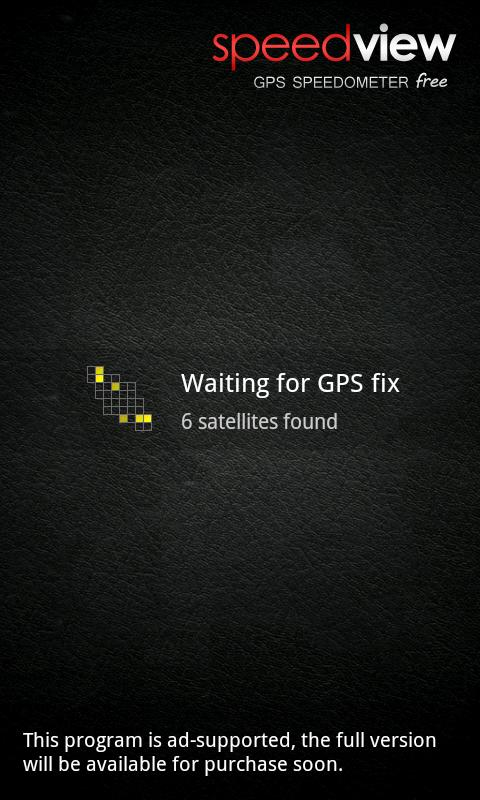
Please note that the accuracy depends on your GPS reception quality. If you have any questions or comments, feel free to post them on our blog.
NOTE: Contains ads. A paid version is also available.
Like it? Share with your friends!
Supported operating systems:
Google Android 1.0, Google Android 1.5, Google Android 1.6, Google Android 10.x, Google Android 2.0, Google Android 2.1, Google Android 2.2, Google Android 2.3, Google Android 3.0, Google Android 3.1, Google Android 3.2, Google Android 4.0, Google Android 4.1, Google Android 4.2, Google Android 4.3, Google Android 4.4, Google Android 5.x, Google Android 6.x, Google Android 7.x, Google Android 8.x, Google Android 9.x
Similar Software:
GeoLog GeoLog saves the sensors data (gps, accelerometer, magnetometer data, etc.) of your device to a log file and calculates the coverage of the site. The coverage is a ratio of the track covering area to the area of the site (expressed in percents)
Ncompass A target compass and place management application
GPS Status & Toolbox GPS Status & Toolbox - Be a GEEK: Get the most out of your phone. Raw GPS data at your fingertips.
Display your GPS and sensor data: position and signal strength of satellites, accuracy, speed, acceleration, bearing.
Tools included: compass with magnetic and true north, leveling tool, mark or share your location and navigate back later
iPocket Tools Deluxe Best deal EVER! Why pay for 9 applications that may not be as good, when you can get all of these quality applications in ONE? ✓Bubble Level ✓Caliper ✓Clinometer/Inclinometer
✓Flashlight ✓Plumb bob ✓Protractor ✓Ruler ✓Voice Battery Tool ✓Voice Compass
Street Race Street Race - App for timing 1/4 mile runs and 0-60mph sprints. Upload your best timings and compare with results from other drivers.
Speedometer operates off phone GPS service. Accuracy is dependent on your phone and satellite reception.
To do a timing run, touch on of the buttons on the first screen
Elevation and Sea Depth Elevation and Sea Depth displays elevation and/or sea depth in direction of phone.In order to use it properly, hold your phone on flat surface and away from ferrous metal objects and electromagnetic fields
Earth Geo Magnetic Field Calculator 3D Earth Geo Magnetic Field Calculator 3D - Earth Geo Magnetic Calculator 3D used to estimate magnetic field at a given point on Earth, and in particular, to compute the magnetic declination from true north
Distance Measurement Distance Measurement - Quick distance calculator, measurement or estimator using:- 1. Screen (for small object) 2. Camera (for short distance) 3. GPS/Network (for long distance) ~~~~~~~~~~~~~~~~~~~~~~~~~~~~~~ A) How to measure using Screen:- 1. Put the object on your phone's screen 2. Drag the button to start measurement B) How to measure distance using Camera:- 1
Super Compass Free Super Compass Free - Super Compass Free is a basic compass application that shows you which direction your phone is pointed. You can use Compass in all outdoor activities as you can think about - walking, sailing, hiking, climbing, camping, flying, reading a map and so much more
Talking Compass Talking Compass speaks your current heading and provides haptic feedback as your cross over any of the cardinal directions.
Touch the screen to hear your heading. Stroke the screen up/down to adjust verbosity
Other Software by developer «Code Sector»:
SpeedView: GPS Speedometer SpeedView: GPS Speedometer - An advanced speedometer application that offers lots of useful features.
SpeedView uses the phone's built-in GPS system to show your current, maximum and average speed, as well as direction, total distance and time traveled. Suitable for running, car driving, biking or hiking
Maverick Off-road GPS navigator with offline maps support, compass and track recording. Use offline maps and GPS even without an internet connection. This app is great for hiking, boating, geocaching and other outdoor activities