Buy Apple iPhone 11 Pro A2215 Global Dual SIM TD-LTE 256GB (Apple iPhone 12,3) Hohe Tauern National Park - GPS Map Navigator Application in Travel & Navigation Tag
Platforms: iPhone, iPad, iPod Touch, Apple iPhone OS
Categories: Travel & Navigation
Upload date: 5 Sep 11
Developer: Flytomap
License: Commercial
Price: 2.99 $
Downloads: 30
Hohe Tauern National Park - GPS Map Navigator - FlytoMap provides complete, quick and easy to use map applications for navigation for iPhone. Continues in the tradition of offering depth of information and functionality across expected places all over the world, exploring the map you get maximum details obtaining detailed information of every object on the map.
FlytoMap processes different types of maps for navigation for different categories:
WATER MAPS (Marine):
Water map navigator is the new ‘Marine Navigator for iPhone’ contains embedded Electronic Nautical Charts (ENC) from NOAA compressed to a large coverage. You can now download the application and transform your iPhone in a chart plotter with best NOAA, ENC S57 cartography; which includes Anchoring areas, Fishing areas, restriction areas, obstructions, rocks, Buoys, Beacons, Lights, Depth contours with Values display on map, Spot Soundings and more. The only marine app available in the market with such huge information. Every effort is made to be as accurate as possible when presenting information for every destination.
PARK MAPS:
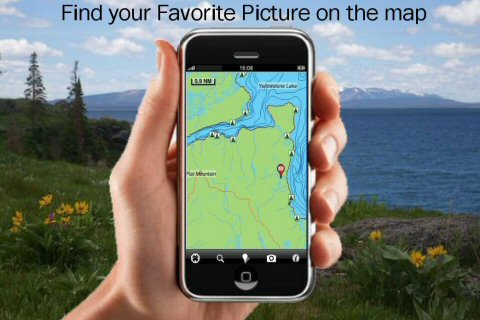
Park map applications are extremely advanced contains embedded electronic charts with all information collected from the National Park Service and local sources. The maps contain all multiple trails (Hiking, biking, Stairway trails, Bicycle trails, Equestrian trails etc.,) and Point of interests (POI) like Campgrounds, Eating places, Ranger Stations, Picnic areas, Boat/Canoe launching, Parking areas etc., which are provided depending on the relevant park areas they exist.
LAKE MAPS:
We offer high quality lake maps with detailed information and important features compressed to assure the larger coverage in USA region. Lake maps contain most important DNR lakes with detailed ‘Depth Contours, Boat Ramps, Fishing spots etc. Also includes Trails, Roads and Railways information.
TRAVEL MAPS:
These Maps treat you mostly with information of both Marine and terrain correspondingly. These are the most preferable Maps to travel especially for fascinating recreational voyages, map focus the best Beach spots along the Coast line, Major ports, Sailing, Fishing, Picnic areas, Parks, Hiking, Biking, Clubs, restaurants, Famous Hotels, Museums, Shopping areas, and much more.
· Use Latitudes and Longitudes to go to your favorite places
· Insert the target/destination 'Waypoint' and see in real time your speed, distance and direction to destination
· Insert Unlimited Markers near favorite places on the map
· Search your Favorite points directly
· Zoom, Rotate and Pan fast just by a finger touch
· Navigate and see your GPS position on the map
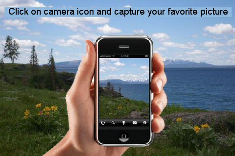
· Geo-Tagged photo management
· Set On/Off Elevation Contours if you feel data is cluttering
What's New in This Release:
· Minor bug Fixed
Like it? Share with your friends!
If you got an error while installing Themes, Software or Games, please, read FAQ.
Supported operating systems:
Apple iOS 10.x (iPad), Apple iOS 10.x (iPhone), Apple iOS 11.x (iPad), Apple iOS 12.x (iPad), Apple iOS 12.x (iPhone), Apple iOS 4.0.x (iPhone), Apple iOS 4.0.x (iPod Touch), Apple iOS 4.2.x (iPad), Apple iOS 4.2.x (iPhone), Apple iOS 4.2.x (iPod Touch), Apple iOS 4.3.x (iPad), Apple iOS 4.3.x (iPhone), Apple iOS 4.3.x (iPod Touch), Apple iOS 5.0 (iPad), Apple iOS 5.0 (iPhone), Apple iOS 5.0 (iPod Touch), Apple iOS 6.0 (iPad), Apple iOS 6.0 (iPhone), Apple iOS 6.0 (iPod Touch), Apple iOS 7.0 (iPad), Apple iOS 7.0 (iPhone), Apple iOS 7.0 (iPod Touch), Apple iOS 8.x (iPad), Apple iOS 8.x (iPhone), Apple iOS 8.x (iPod Touch), Apple iOS 9.x (iPad), Apple iOS 9.x (iPhone), Apple iOS 9.x (iPod Touch), Apple iPhone OS 3.1.x, Apple iPhone OS 3.1.x (iPod Touch), Apple iPhone OS 3.2.x (iPad)
Similar Software:
Navfree GPS Live Norway Navfree GPS Live Norway - Navfree is a free GPS navigation solution for iOS devices. The app uses OpenStreetMap data, created and updated by thousands of users from all over the world.
The maps are stored locally on the device, so there is no need for a data connection
Cuyahoga Valley National Park - GPS Map Navigator Cuyahoga Valley National Park - GPS Map Navigator - Continues in the tradition of offering depth of information and functionality across expected places all over the world, exploring the map you get maximum details obtaining detailed information of each object on the map
Erie (PA, USA) Map Offline Erie (PA, USA) Map Offline - This will be perfect when you are traveling and you don't have internet connection. This Offline Maps is not a replacement of Google Maps. It is used when you don't have internet connection and want to use maps
Sygic Iberia: GPS Navigation Sygic Iberia: GPS Navigation - Sygic is a voice guided GPS navigation application. It's packed with TomTom maps and a robust set of navigation features. Both app and maps are updated for free. Maps are stored on the phone for offline use
Heidelberg Maps Offline Heidelberg Maps Offline - This will be perfect when you are traveling and you don't have internet connection. This Offline Maps is not a replacement of Google Maps. It is used when you don't have internet connection and want to use maps
India GPS India GPS is a professional Car, Bike and Pedestrian navigation system for iPhone and iPad. This system not only for Car navigation, but also for pedestrian.
· 2D and 3D navigation mode and map.
· The speed is very fast.
· Using vector map which owns small size and can zoom in any level.
· Elegant operations
Bielefeld (Germany) Map Offline Bielefeld (Germany) Map Offline - This will be perfect when you are traveling and you don't have internet connection. This Offline Maps is not a replacement of Google Maps. It is used when you don't have internet connection and want to use maps
Iran GPS Iran GPS is a professional Car, Bike and Pedestrian navigation system for iPhone and iPad. This system not only for Car navigation, but also for pedestrian.
· 2D and 3D navigation mode and map.
· The speed is very fast.
· Using vector map which owns small size and can zoom in any level.
· Elegant operations
Athens GPS Guide The only thing we do, help you to move freely as an alien, by "Offline" & "GPS"
Mobile Maps Gulf Countries GPS Navigation Mobile Maps Gulf Countries GPS Navigation - Sygic Mobile Maps is the most complete turn-by-turn, voice guided navigation software for your mobile phone.
· All maps with you on your phone - Bahrain, Kuwait, Oman, Qatar, Saudi Arabia and United Arab Emirates from TomTom.
· Free map updates.
· Speed camera crowd-sourcing protects your wallet
Other Software by developer «Flytomap»:
Shawnee National Forest - GPS Map NavigatorMap Shawnee National Forest - GPS Map NavigatorMap - Continues in the tradition of offering depth of information and functionality across expected places all over the world, exploring the map you get maximum details obtaining detailed information of each object on the map
Lake Mead - Fishing Lake Mead - Fishing - Lake Mead offers year round recreational opportunities. Lake delights to boaters, swimmers, fishermen and wildlife viewers. Lake Mead is the 16th largest man made lake in the world. It occupies about 1.5 million acres and about 820 miles of shoreline
Abruzzo, Lazio e Molise National Park - GPS Map Navigator Abruzzo, Lazio e Molise National Park - GPS Map Navigator - FlytoMap provides complete, quick and easy to use map applications for navigation for iPhone. Continues in the tradition of offering depth of information and functionality across expected places all over the world, exploring the map you get maximum details obtaining detailed information of every object on the map
Marine: Melbourne HD - GPS Map Navigator Marine: Melbourne HD - GPS Map Navigator - FlytoMap provides complete, quick and easy to use map applications for navigation for iPad. Continues in the tradition of offering depth of information and functionality across expected places all over the world, exploring the map you get maximum details obtaining detailed information of every object on the map
Cevennes National Park - GPS Map Navigator Cevennes National Park - GPS Map Navigator - FlytoMap provides complete, quick and easy to use map applications for navigation for iPhone. Continues in the tradition of offering depth of information and functionality across expected places all over the world, exploring the map you get maximum details obtaining detailed information of every object on the map
Marine : US West (From California to Bering Sea) - Water Map Navigator Marine : US West (From California to Bering Sea) - Water Map Navigator - Continues in the tradition of offering depth of information and functionality across expected places all over the world, exploring the map you get maximum details obtaining detailed information of each object on the map
New Caledonia - GPS Map Navigator New Caledonia - GPS Map Navigator - FlytoMap provides complete, quick and easy to use map applications for navigation. Continues in the tradition of offering depth of information and functionality across expected places all over the world, exploring the map you get maximum details obtaining detailed information of every object on the map
Barbados - GPS Map Navigator Barbados - GPS Map Navigator. FlytoMap provides complete, quick and easy to use map applications for navigation for iPhone. Continues in the tradition of offering depth of information and functionality across expected places all over the world, exploring the map you get maximum details obtaining detailed information of every object on the map
Redwood National Park - Standard Redwood National Park - Standard - Continues in the tradition of offering depth of information and functionality across expected places all over the world, exploring the map you get maximum details obtaining detailed information of each object on the map
Joshua Tree National Park - GPS Map Navigator Joshua Tree National Park - GPS Map Navigator - Continues in the tradition of offering depth of information and functionality across expected places all over the world, exploring the map you get maximum details obtaining detailed information of each object on the map
Comments on Hohe Tauern National Park - GPS Map Navigator:
Comments not found
If you noted an error or download link is broken, please, report it via this page or use comments.
Hohe Tauern National Park - GPS Map Navigator is compatible with your device Apple iPhone 11 Pro A2215 Global Dual SIM TD-LTE 256GB (Apple iPhone 12,3)

")


 Map Offline")


 Map Offline")


 - Water Map Navigator")


