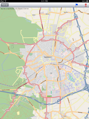
Apeldoorn Street Map for iPad - Do you feel online Google Maps is too slow showing you the map? Do you want an easy way to mark and remember where you are? Do you need a list of streets where you are? You don’t want to carry around a big unwieldy paper map? Tired of having the paper map blown to pieces by the wind every time you try to figure out where you are and where you need to go?
The mobile streetmaps are for you! All the map data is loaded on your iPad before you leave your home, so can you be on the streets, offline, and still know everything about the area you are in, and locate yourself or any street in the city. You don't need any network connection at all once the application is installed on your iPad - no WiFi, no 3G, no GPRS!
This is a complete street level map for your iPad. The entire map is stored on your iPad, so it works where you have no access to the Internet - it works where Google Maps is inaccessible. This prevents expensive data roaming charges by loading all the map data to your iPad before you leave home. You can turn off all network functions and still be able to find your way around. Lets you find all streets, and many useful locations such as ATM's, parkings, museums, and many others. Remembers where you've been so you can find that parking spot where you left your rental car, or that great restaurant. Allows you to mark interesting locations to visit in advance.
Map data (c) OpenStreetMap and contributors, CC-BY-SA.
Like it? Share with your friends!
If you got an error while installing Themes, Software or Games, please, read FAQ.
Supported operating systems:
Apple iOS 10.x (iPad), Apple iOS 11.x (iPad), Apple iOS 12.x (iPad), Apple iOS 4.2.x (iPad), Apple iOS 4.3.x (iPad), Apple iOS 5.0 (iPad), Apple iOS 6.0 (iPad), Apple iOS 7.0 (iPad), Apple iOS 8.x (iPad), Apple iOS 9.x (iPad), Apple iPhone OS 3.2.x (iPad)
Muritz National Park - GPS Map Navigator Muritz National Park - flytoMap provides complete, quick and easy to use map applications for navigation for iPhone. Continues in the tradition of offering depth of information and functionality across expected places all over the world, exploring the map you get maximum details obtaining detailed information of every object on the map
Marine: Coral Sea HD - GPS Map Navigator Marine: Coral Sea HD - GPS Map Navigator - FlytoMap provides complete, quick and easy to use map applications for navigation for iPad. Continues in the tradition of offering depth of information and functionality across expected places all over the world, exploring the map you get maximum details obtaining detailed information of every object on the map
Angelina National Forest - Standard Angelina National Forest - Standard - Continues in the tradition of offering depth of information and functionality across expected places all over the world, exploring the map you get maximum details obtaining detailed information of each object on the map
Google Maps (iPhone) Google Maps (iPhone) - Google Maps is a comprehensive map solution for iOS devices. It offers accurate maps, voice guided turn-by-turn driving directions, live traffic information, public transit directions, Street View, and more.
With Google Maps, you can easily find points of interest around you, such as restaurants, pubs, shops, hotels, and more
Johannesburg Travel Guide - Lonely Planet Johannesburg Travel Guide - Lonely Planet - Discover the best places to see, shop, eat, drink and sleep in the vibrant heart of South Africa with Lonely Planet’s Johannesburg City Guide on your iPhone
Atlanta Maps Atlanta Maps - software that helps you download and store the travel maps and plans you need. This super-handy app lets you download publicly available maps and store them on your iPhone or iPod Touch. You can download the maps when you have fast wifi connection - and then use any time in the future without delay
Victorville (CA, USA) Map Offline Victorville (CA, USA) Map Offline - This will be perfect when you are traveling and you don't have internet connection. This Offline Maps is not a replacement of Google Maps. It is used when you don't have internet connection and want to use maps
Florence Travel Guide - Lonely Planet Florence Travel Guide - Lonely Planet - Discover the best places to see, shop, eat, drink and sleep in the cradle of the Renaissance with Lonely Planet’s Florence City Guide on your iPhone
Chisinau Street Map Lite Chisinau Street Map Lite - Lets you find all streets, and many useful locations such as ATM's, parkings, museums, and many others. Remembers where you've been so you can find that parking spot where you left your rental car
Siem Riep (Angkor Wat) Street Map Siem Riep (Angkor Wat) Street Map - Lets you find all streets, and many useful locations such as ATM's, parkings, museums, and many others. Remembers where you've been so you can find that parking spot where you left your rental car
Curacao Street Map Lite Curacao Street Map Lite - Lets you find all streets, and many useful locations such as ATM's, parkings, museums, and many others. Remembers where you've been so you can find that parking spot where you left your rental car
Clermont-Ferrand Street Map Lite Clermont-Ferrand Street Map Lite - Lets you find all streets, and many useful locations such as ATM's, parkings, museums, and many others. Remembers where you've been so you can find that parking spot where you left your rental car
Atlantic City Street Map Atlantic City Street Map - lets you find all streets, and many useful locations such as ATM's, parkings, museums, and many others. Remembers where you've been so you can find that parking spot where you left your rental car
Ankara Street Map Ankara Street Map - Lets you find all streets, and many useful locations such as ATM's, parkings, museums, and many others. Remembers where you've been so you can find that parking spot where you left your rental car

")


")


 Map Offline")


 Street Map")


