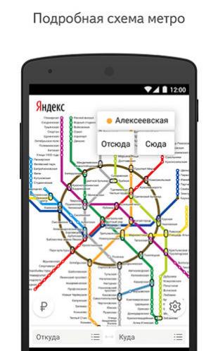
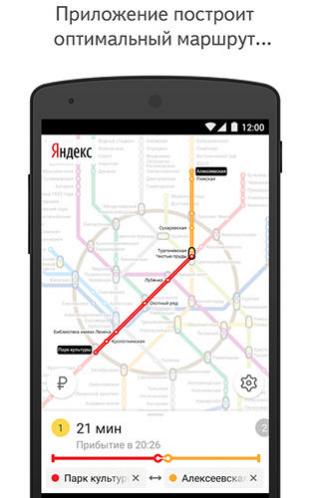
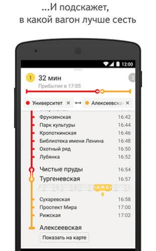
Yandex. Metro - is a useful application for those who often goes by subway. The application will make exact calculation of time, offer the best route and give the switch points. Select the destination and departure stations according to the scheme and easily plan your subway trips.
Game features:
Time calculation including switch points
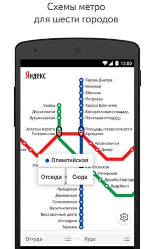
Up-to-date schemes
Work in offline mode
Scheme for each route
Loading video...
Like it? Share with your friends!
Supported operating systems:
Google Android 10.x, Google Android 4.0, Google Android 4.1, Google Android 4.2, Google Android 4.3, Google Android 4.4, Google Android 5.x, Google Android 6.x, Google Android 7.x, Google Android 8.x, Google Android 9.x
Similar Software:
zhiing zhiing connects people-to-people, people-to-places and people-to-services with dynamic maps and turn-by-turn driving directions. Forget about map printouts or scribbling down directions....use zhiing! Simply enter the mobile number you want to zhiing and hit send
Maps.Me: Offline mobile maps Maps.Me: Offline mobile maps - is an application which provides fast access to the maps of all countries and allows you to make best routes without requiring Internet connection
TripComputer TripComputer is a personal off-road GPS navigation utility software for Android phones, that has been created for active people, who love travel by hike or bike.
The application does not use Internet connection or Google Maps for navigation or track recording, but you can share your data to others, or store your data on server
OSMTracker for Android OSMTracker stands for OpenStreetMap Tracker. It allows you to track your journey and mark significant way points. Way points can be marked with a tag using a button, with a quick voice record, a text note or by taking a picture. The various button pages and layouts can be customized to suit your OpenStreetMap activities
Geosearch Geosearch is a free/open source application which allows you to monitor the movement of users on a Google map. You can send SMS, make calls and find the optimal road to reach another user
GoPenS GoPenS is an OpenSource GPS application for Android phones, based on OpenStreetMap (OSM). OpenStreetMap is a collaborative map of the world. Therefore, one of the main functions of the application is to be able to record a trace and send it as a GPX to the OSM servers, and so edit the OSM Map
yozi yozi is a navigation software for the Android platform. It uses digital topographic maps in well-known Ozi Explorer formats for navigation and doesn't require network access like built-in Maps application on Android
Street View on Google Maps Street View on Google Maps - New! Street View smart navigation -- move around by dragging "Pegman" where you want to go. Try Street View on Google Maps to view street-level imagery from your phone. To use Street View, open Google Maps, search for a place or long-press the map, and tap the Street View option
Locus - addon AR This is BETA version of simple addon for Locus mapping application (version 1.1.0 and higher). Allow to show actual POI's visible on map, in Augmented reality view. In Locus Free, usage is limited to 1 minute. This addon do not have any screen or widget
Comments on Yandex. Metro:
Comments not found
If you noted an error or download link is broken, please, report it via this page or use comments.
Yandex. Metro is compatible with your device Amoi N828


")

