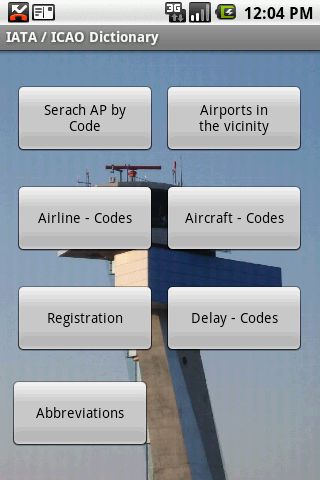
IATA / ICAO Dictionary -This application is an offline database for IATA / ICAO airport, airline, aircraft, delay codes and aircraft registration codes.
The airport database provides:
- Name
- Elevation
- Latitude and Longitude coordinates,
- timezone,
- runway and communication information (not every airport)
- Metar / TAF reports (not every airport)
- google map (not every airport)
- sunrise / set calculation
- find other airport in the vicinity of the selected airport or from your present position (GPS required)
- calculate the distance to the selected airport (GPS required)
The airline database provides:
- Name
- Country
- Callsign
- picture of the airline with airliners.net
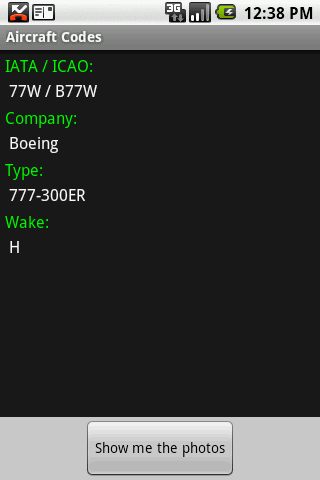
The aircraft database provides:
- Company
- Type
- wake category
- picture of the aircraft with airliners.net
Other functions are:
AC registrations; selection by
- country - registration
- registration - country
Delay codes
general aviation abbreviations
Like it? Share with your friends!
Supported operating systems:
Google Android 1.5, Google Android 1.6, Google Android 10.x, Google Android 2.0, Google Android 2.1, Google Android 2.2, Google Android 2.3, Google Android 3.0, Google Android 3.1, Google Android 3.2, Google Android 4.0, Google Android 4.1, Google Android 4.2, Google Android 4.3, Google Android 4.4, Google Android 5.x, Google Android 6.x, Google Android 7.x, Google Android 8.x, Google Android 9.x
Similar Software:
DC Metro Transit - Free Realtime predictions for Washington DC MetroRail, MetroBus and other local buses Free (with ads) mobile interface for WMATA: -Tablet friendly layout (Honeycomb Compatibility) -Real-time predictions: DC Metrorail, Metro Bus, Circulator, PG County-The Bus, Fairfax CUE, UMD Shuttle
London Hotels Search London Hotels Search Book Cheap London Hotels. Save Up to 80% London City Hotels The world's largest hotel search engine that combines all hotel deals from the best travel sites into one free, quick and easy search. Genius!
Eigene Anreise - Urlaubssuche Mit dieser App können Sie nach Reiseangeboten für Ihren Urlaub mit eigener Anreise per Auto, Bahn oder Flug suchen und sich über einen Preisvergleich Angebote der verschiedenen Reiseveranstalter zu den einzelnen Hotels anzeigen lassen
TripIt No Ads for Android TripIt No Ads for Android - TripIt is is a useful app which organizes your travel plans into an itinerary that has all the details of your trip in one place. Simply forward airline, car rental, hotel and restaurant reservations to TripIt, and you will be able to access them from anywhere
Amsterdam Metro This app grants you fast acces to the last Amsterdam metro map, no internet connection needed once it has been installed. Full zoom controls. Fast, light and simple
Istanbul Bus Istanbul Bus helps travelers to find the correct bus route in Istanbul. Enter your current place and target, Istanbul Bus will calculate the optimal route on the IETT bus lines. From and to fields offer suggestions while the user enters stop names
Renvida Renvida Property For Sale and To Rent in Spain
Metro Guide Metro Guide will provide complete information about location (address with map, route, website, phone number). & Help you to find the easiest route to the destination.
Categories
aMetro aMetro - shows the maps of transit systems all over the world - subways, metro, buses, trains, and other. You can find the right route between stations and estimate travel time.
What's New in This Release:
· Spanish translation
Other Software by developer «Steve Dexter»:
Snowtam Decoder Snowtam Decoder - You have a snowtam in the metar report, you want to decode. Snowtam Decoder does it for you.
· Decoding of a snowtam in metar format
· Explanation of the items (A ,B , C, ..
Guess the X Guess the X - With this game you can guess a flag, a capital, a land and boundaries.
There are four input methods available to enter the answer: an autocomplete editbox, via a listview, multiple choice and a tap mode.
There are also options to change the color, size and font
Aviation Weather with Decoder Aviation Weather with Decoder - An easy way to receive metar and TAF reports from NOAA