Back Country Navigator - is a handy navigator which will help you find way in any location. The application has embedded storage so you can download the needed data and use maps without Internet connection. All you need to do is to activate a satellite navigation to see your location.
Game features:
Fast download
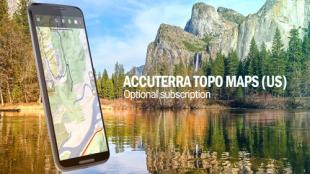
Data of geological surveys
Display of other ways
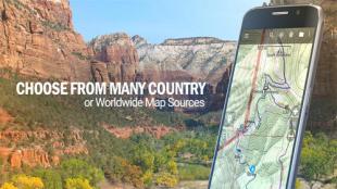
Support of contour maps
Like it? Share with your friends!
Supported operating systems:
Google Android 10.x, Google Android 4.0, Google Android 4.1, Google Android 4.2, Google Android 4.3, Google Android 4.4, Google Android 5.x, Google Android 6.x, Google Android 7.x, Google Android 8.x, Google Android 9.x
Similar Software:
Redpin The aim of the Redpin project is to create an open source system that allows indoor positioning up to room-level description using mobile phones
CompassNavi Compass / Navigation Activity, mainly for OpenGPX, but can be used from any application
Redpin The aim of the Redpin project is to create an open source system that allows indoor positioning up to room-level description using mobile phones
OpenGPSTracker OpenGPSTracker adds the capability to store and review where you and your Android device have been. Basically you press record at the start of your trip and your phone stores the route you take. This route is drawn real-time on the Maps functionality of Android or in the background with an idle device. The route is stored on your phone for review and further use
Location Tracker Why do you need Location Tracker application? 1. Track, monitor and manage an individual or group of people for operational and safety security reasons. 2. Send an instant alert in emergency situation by pressing the Panic button
My Fleet Geofence My Fleet Geofence - Why do you need My Fleet Geofence application?
1. With My Fleet Geofence, you can create a specific "safe zone" or "unauthorized zone" on a map and get an E-mail Alert if the phone leaves the area.
2. Receive an instant alert in case of breach of specific zone.
How to start?
1. Install the application on your Android phone.
2
OSMTracker for Android OSMTracker stands for OpenStreetMap Tracker. It allows you to track your journey and mark significant way points. Way points can be marked with a tag using a button, with a quick voice record, a text note or by taking a picture. The various button pages and layouts can be customized to suit your OpenStreetMap activities
TapIn Places TapIn Places is all about your daily check-in places by tap.
· View nearby places around your location.
· Shared Facebook wall posting.
· Search your favorite places with or without categories simply.
· Manage recent and favorite places.
· Bookmarks your favorite places simply.
· Long click item list to view action detail
MapMyRIDE GPS Cycling Riding MapMyRIDE GPS Cycling Riding - tracks the route, distance, pace, and more in real-time using GPS.
NEW: iMapMyRIDE+ for Android
iMapMyRIDE+ brings you its mobile app for Android-based devices! Now owners of Android 2
Tricorder Tricorder - A simple tricorder simulator for Android powered phones, using real sensors to detect magnetic fields, gravity, etc. See the passing gravity wave from a distant collapsar on your phone screen (actual device sensitivity may be insufficient to detect gravity waves). Detect buried powerful magnets! Be a mega-geek! Etc
Comments on Back Country Navigator:
Comments not found
If you noted an error or download link is broken, please, report it via this page or use comments.
Back Country Navigator is compatible with your device Alcatel One Touch Pixi 4 4.0 8GB