Turbo GPS 2 (Android) - The known all-in-one GPS for Android devices, now in version 2.
· Improved graphics
· Track categories
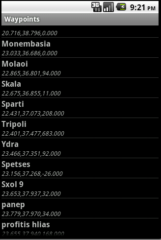
· Waypoint categories
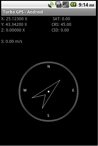
· Better compass and direction systems
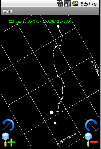
· Supports map rotation
· Debugging GPS functions and Simulation track mode
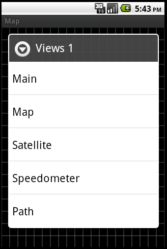
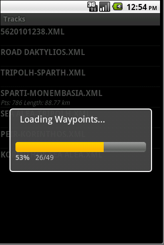
· Tracks/Waypoints (compatible with Turbo GPS 1)
· Unlimited waypoints, tracks, sensors, satellites
· Import from LOC, GPX, KML
· Export to LOC, GPX, KML, KMZ
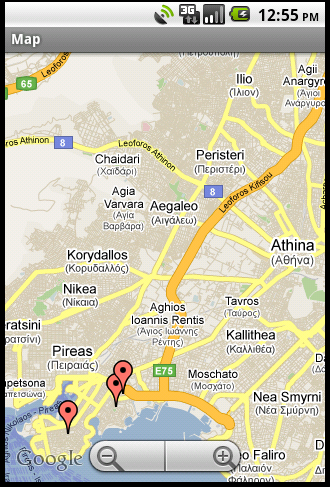
· Google maps
· OpenStreet maps
· TGPS maps
· Custom GPS provider support (including Bluetooth external GPS)
· Can download directions from Google Maps
· Internet Tracking. Posts 3 items with %f, for example http://www.test.com/post.php?&x=%f&y=%f&z=%f
· Internet Pursuit. Requires a response format of x y z (space separated), for example 25.95 23.05 13
What's New in This Release:
· Added ability to export google directions items (waypoints/tracks) at once from the menu.
· Made easier navigation to tracks/waypoints, now they open on click and there is long click for menus.
· Added transit option for directions.
What's New in 2.322:
· Enhanced google directions with modes and shows time/km.
What's New in 2.296:
· Tablet optimized version
· New action bar in main screen and others
· Better ad placement
· Live map ability in Waypoints/Tracks
What's New in 2.290:
· Updated Maps v4 for older devices.
· More enhancements in Maps v4 + Tracking mode when recording in maps.
What's New in 2.280:
· More options for importing KML files.
· Fixed more new v4 maps.
· Added ability to edit a waypoint by entering values in deg/min/sec.
· Added experimental 4x1 (resizeable) WIDGET.
· Fixed issues in touching,rotating and moving the new Maps.
What's New in 2.268:
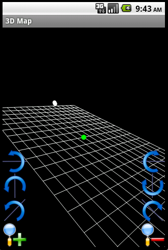
· New experimental Maps v.4 for new API and 3D maps
· Added menu in Maps v.4. Progress is done. Wanderer mode also there.
· Added permission for OpenGL Android 4+ MapViews.
· Fixed ads.
· Removed unused libraries, Turbo GPS is now a bit smaller.
· In new "Wanderer" mode it shows total length.
· Fixed some bugs in Wanderer mode
· Fixed some bugs in Italian translation.
· Enhanced speed in maps when rotation is not used.
What's New in 2.247:
· New mode "Wanderer". Select that and you can record your walking, record check-points and the map automatically rotates based on compass.
· New mode for map rotation "Compass" , uses the internal compass to rotate the map.
· Map rotation ugly scaling fixed.
What's New in 2.240:
· Added Italian Language (Thx to Zoia Mauro).
· Added What's new Screen.
What's New in 2.238:
· Fixed the Import Crash bug.
What's New in 2.232:
· Supported "generic sending" for all exports (not only KML) to either Bluetooth or to DropBox/Gdrive/SkyDrive, if the application is installed.
· Ability to request Google Geocoding for a waypoint.
· Ability to request Google Elevation for a waypoint.
· Ability to request Google Directions at run time while playing back a track.
What's New in 2.208:
· Added help file and fixed some small bugs.
What's New in 2.206:
· Turbo GPS now runs in Android 1.5.
· Fixed KML imports.
· Fixed Z representation in units.
What's New in 2.202:
· Fixed maidenhead grid in XYZ and waypoints.
· Added ability to send waypoints/tracks to recipient (mail, bluetooth, etc).
· Added ability to handle incoming KML files to import as tracks or waypoints.
What's New in 2.194:
· Added maidenhead grid in XYZ and waypoints.
· Small layout and bug fixes.
What's New in 2.192:
· Fixed bug in single-waypoint tracks
· Enhanced current position indication
What's New in 2.190:
· Fixed a bug in Tracking
· Improved 4.1 Jelly compatibility.
What's New in 2.182:
· Added Pager; Now main screen can be scrolled horizontally. At the moment, "Main" "Flight" and "Satellites" can be added (new option in Preferences).
· Fixed "goto" bug.
· Fixed Calculator precision.
· Added Calculator (for distances and areas).
· Added track and POI export format to TXT.
What's New in 2.148:
· Fixed NMEA Server bugs.
· Minor translation issues fixed.
What's New in 2.142:
· Fixed Bearing Bug.
· Updated compatibility with Android 4.0.
· New Icons.
What's New in 2.130:
· NMEA TCP Server added. Turbo GPS can now send NMEA data to any connected client.
· Polish translation added. Thanks to Mr. Adam Kaczmarek.
· Track URL now does not accept %f and %s, it always posts everything. Contact me for details.
What's New in 2.128:
· Polish translation added. Thanks to Mr. Adam Kaczmarek.
· Track URL now does not accept %f and %s, it always posts everything.
What's New in 2.124:
· Added %s parameter to Tracking to post a unique ID and various bug fixes.
· Added "Capture" option in maps: Now you can capture waypoints, draw tracks, generate google directions by tapping /dragging the screen in google maps.
Like it? Share with your friends!
Supported operating systems:
Google Android 1.5, Google Android 1.6, Google Android 10.x, Google Android 2.0, Google Android 2.1, Google Android 2.2, Google Android 2.3, Google Android 3.0, Google Android 3.1, Google Android 3.2, Google Android 4.0, Google Android 4.1, Google Android 4.2, Google Android 4.3, Google Android 4.4, Google Android 5.x, Google Android 6.x, Google Android 7.x, Google Android 8.x, Google Android 9.x
Similar Software:
MozStumbler MozStumbler - Mozilla Location Service is an experimental project that aims to provide location-based services using data collected from users. The objective is to create a database of cell towers and WiFi access points that mobile devices can use to retrieve their location instead of having to rely on GPS
LocateMyBuddyPRO LocateMyBuddy(aka LMB) is a GPS tracker and having features like "GPS Group/Friends Tracker" + "GPS Navigator" + "Friend Finder" + "GPS Location Sharing with Map URL" + "Follow Me" + "Email/Text service" + "Hybrid/Standard Map" + "GPS Location Address display Along With GPS Co-ordinates"
Osm2GpsMid GpsMid is a free, fully offline, vector based map application for your mobile phone. It displays your current position on a zoomable map and can be used to search for and navigate to roads or points of interest of your liking. As all data is stored in a compact binary format on your mobile phone you will incur no charges for extra data downloads
OpenSatNav OpenSatNav brings open-source satellite navigation to Android handsets.
· All code is open source.
· Global maps and navigation based on OpenStreetMap data
· Navigation by car, bicycle or by foot
Family Safety Family Safety - Active and Passive - Managed Family Safety & Security System!
★ Your Family Safety and Security by location aware real time notifications.
★ Create location aware multiple geo-fence’s to get automatic security alerts when person is not within the specified zone
MileageLedger (Android) MileageLedger is a GPS powered mileage logging application designed for Android enabled phones. The paid version of MileageLedger generates log files that meet requirements of IRS Publication 463, Section 5 which states:
"You should keep adequate records to prove your expenses or have sufficient evidence that will support your own statement
yozi yozi is a navigation software for the Android platform. It uses digital topographic maps in well-known Ozi Explorer formats for navigation and doesn't require network access like built-in Maps application on Android
TomTom Eastern Europe for Android TomTom Eastern Europe for Android - TomTom Eastern Europe is a turn-by-turn GPS navigator for Android devices. The app includes accurate offline maps, so you can find your way anywhere, even without an internet connection
TripComputer TripComputer is a personal off-road GPS navigation utility software for Android phones, that has been created for active people, who love travel by hike or bike.
The application does not use Internet connection or Google Maps for navigation or track recording, but you can share your data to others, or store your data on server
AugSatNav Walk AugSatNav is an augmented reality navigation system which overlays walking directions upon a live video feed of the path or road ahead.
With AugSatNav there is no need to follow instructions or interpret maps - you can simply find your way by walking along the route highlighted by a bright white line
Other Software by developer «Chourdakis Michael»:
Teh Wake On Lan Teh Wake On Lan is a simple tool to configure your Wake-On-Lan targets in your LAN
Turbo GPS Turbo GPS -The most flexible and precise track / offroad GPS you have seen. Available for both Windows and Windows Mobile
Eortologio Greek Handy Today plugin, all Greek, can sort with name or date
Remote Debugger Remote Debugger is a tool for developers that allows one to debug an application over IP without ActiveSync
Turbo Mobile Event Turbo Mobile Event-this software act as a call Manager which is dedicated for Windows Mobile 5.0 and later. Features:
- XML configugration.
- Call blocking or call answering, can be set to master mode (kill cprog.exe!).
- Profiles.
- Scheduler.
- Multiple lines.
- Cell id profile
Teh Name Days Teh Name Days - The absolute Name Day reminder in your Today Screen!
Features:
# Today plugin with minimum memory consumption!
# Shows name days
* Static
* Dynamic
* Holidays
* Your friend's namedays based on your contacts!!
# Ability to create extra name days
Turbo Mobile Event Turbo Mobile Event is a freeware Symbian Series 60 application, currently in beta stage. I believe it is the best in its class, because it has features not found in any other call management software.
It allows you to filter incoming calls, sms, mms, e-mail, bluetooth, and infrared messages
Turbo GPS Turbo GPS - The known all-in-one GPS and Sensor manager, now for Android.
Supports waypoints, tracks, sensors, compass, import/export, routes, 3D map and more.
What's New in This Release:
· Less size
· Updated Map when Tracks are drawn
· Fixed bug when Running track (direction arrow)


")
")


")


